- Like Collect Share
-
0 0
- Category: Navigation & maps
- Published by: Dianthus AB ?
-
Permissions:
- Access your Internet connection
- Access your Internet connection and act as a server.
- Access your home or work networks
- Use your location
- Use your webcam
- Use your microphone
- Supported processors: x86, x64, ARM
- Language: English (United States)
- Learn more:
-
Notes:
* 1.1.27 - Improved display of selected features
Walter Maps Free
Walter Maps is a professional tool for online and fully offline geodata collection and editing. You can use it stand alone or as a ready-to-use field data collection tool in your existing geodata environment.
The app comes in two flavors, Walter Maps Free and Walter Maps Pro. Walter Maps Free contains some editing features, and could be regarded as a reader app for geodata and maps produced by Walter Maps Pro. The target audience for Walter Maps Pro is professional users collecting geodata and producing maps.
In this version, Walter Maps Free, you can whenever you want unlock the Walter Maps Pro features monthly, i.e. you only pay for Pro functionality when you need it!
Important information about the Pro unlock subscription:
- The subscription unlocks the Pro functionality.
- This is a monthly subscription.
- The price per month is 25 USD.
- Payment will be charged to your Windows Store account at confirmation of purchase.
- The subscription will not be automatically renewed.
- Your account will be charged with 25 USD at renewal.
- The subscription does not contain any free trial period.
Walter Maps Free and Walter Maps Pro contain the following basic features:
- Multi platform support
- No ads
- Unlimited use
- Shape, TIFF, GeoTIFF & JPEG support
- Support for WMS & WMTS online layers
- Recording of waypoints & tracks
- Easy measurements of coordinates, lengths and areas
- Supports many length and area units, e.g. m, km, feet, miles, yards etc.
- Supports any map projection (projected coordinate system)
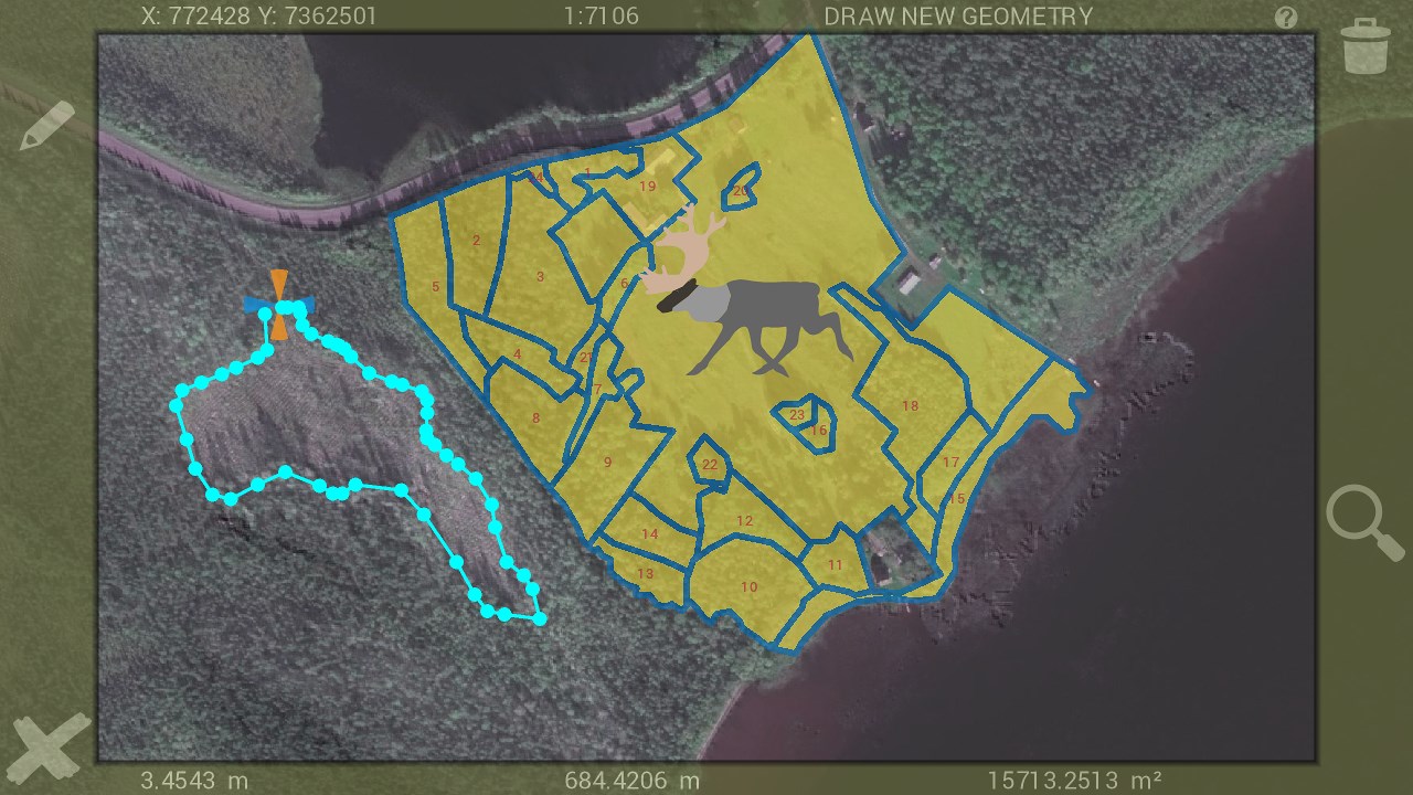
- Add and delete points, polygons & lines
- Collect 2 photos/videos per point, line or polygon feature
- View and edit attributes
- Create own symbologies (one per vector layer)
- More than 400 built in symbols for points
- Use own point symbols in svg-format
- Download single or multiple symbols in svg-format
- Create and open map packages
- Copy GPS position to clipboard
- Use dropbox for sharing and backup of data
- Download layers from http URLs
- Full view access to data collected by Walter Maps Pro
- Multi lingual-support, i.e. create your own language files. Out of the box Walter Maps supports English and Swedish.
- Fully described JSON-based map document and map package format, for developing own read and write routines in other systems.
Walter Maps Pro contains the following additional professional features:
- Merge polygon features
- Multi part features to single part features
- Split polygons by temporary drawn lines
- Split polygons by other line layer
- Clean polygons
- Single step undo of geometry edits
- Create new shape files
- Add new attribute fields to shape files. Deletion of attribute fields is not possible in Walter Maps in order to preserve data consistency with other systems.
- Use custom built rules for creating data collection forms to ensure data quality and completeness
- Tools for assigning date, time, area, uuid etc. to attributes
- Collect any number of photos/videos per feature
- Select photos from device album
- Import points from text files
- Export vector layers to text files or Excel (*.xls)
- Download layers from password protected http URLs
- Email complete map or selected layer
- Launch web-sites based on feature attribute values
- Save WMS & WMTS to offline raster layers
- Cut and resample raster layers
- Export present map view for fast and easy sharing of map snapshots with other people
- Any number of conditional symbologies, i.e. symbology by field based SQL-queries
- Pan to projected or geographic coordinate (x,y or lat,long)
- Measure raster values
- View only map (hide tools for better presentation)
- Quickly alternate layers in the map
- Local backup of vector data
The in app purchase "Unlock Walter Maps Pro" terms of use can be found at: http://waltermaps.com/walter_maps_ppm_terms_of_use/
Features:
- Walter Maps Free is a tool for geodata viewing and collection.
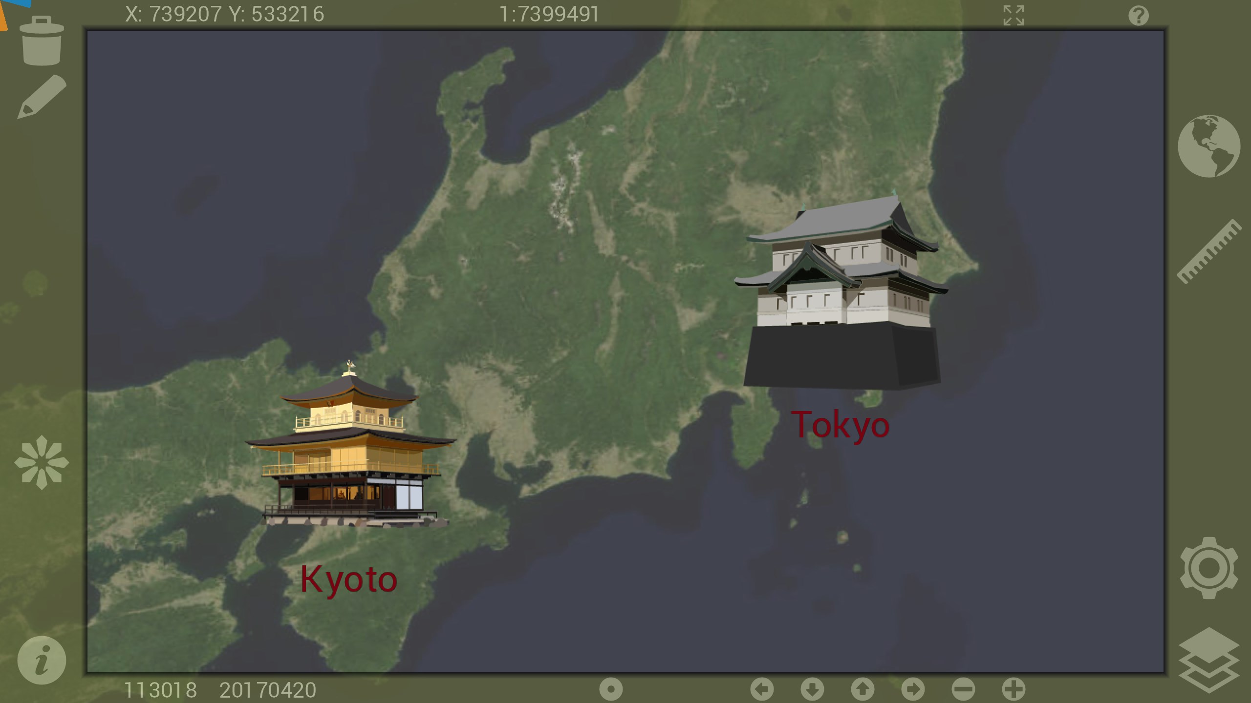
- Walter Maps supports Shape files, GeoTIFF, TIFF, JPEG, WMS & WMTS.
- Register waypoints and tracks. Add and delete points, polygons & lines. View and edit attribute values.
- Add and share data through Dropbox
- Connect photos and videos to points, lines or polygons, maximum 2 photos/videos per feature
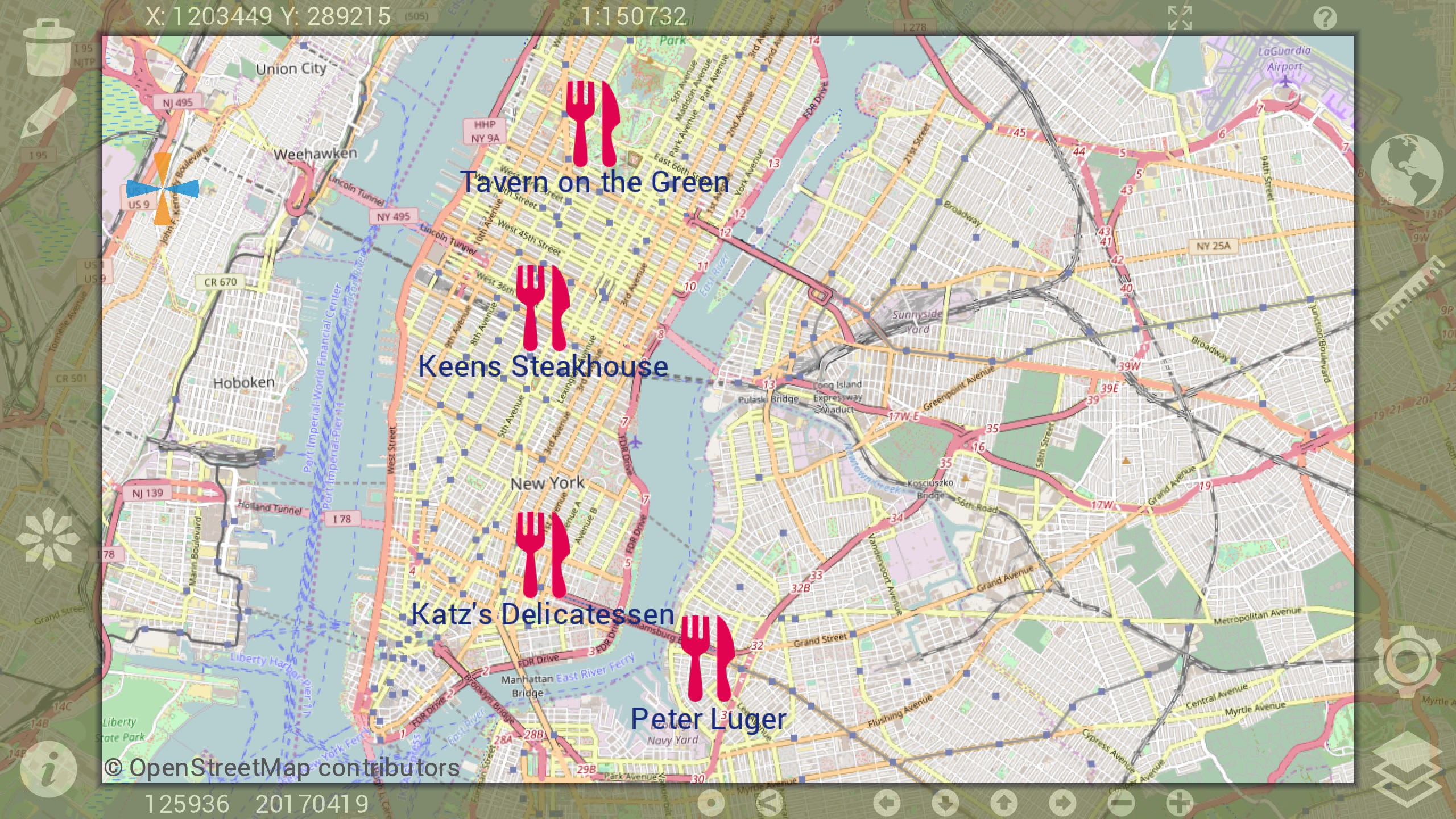
- More than 400 built in searchable point symbols.
- Add custom point symbols in SVG-format (single colored or multi colored).
- Create one symbology per Shape file
- Supports most international length and area units, m, feet, miles, ha, acre etc.
- Easy measurement of coordinates, distances and areas.
- Fully open map document format and map package format, making integration with other systems really easy.
- Supports any projected coordinate systems. Geographic coordinate systems are only supported for online WMS and WMTS layers.
- Copy current GPS position to clipboard.


Similar Apps View all


Comments View all

1 comment
6 June 2017
App does not launch.