- Like Collect Share
-
0 0
- Category: Navigation & maps
- Published by: kitya
-
Permissions:
- Use data stored on an external storage device
- Use your location
- Use your device network services
- Use any of your Windows Phone sensors
- Access your browser
- Use an anonymous Microsoft account
- Use the photos in your media library
- Use your maps
- Use your media library
- Supported processors: x86, x64, ARM
- Language: Italian, English, French, Swedish, Polish , Spanish (Spain), Portuguese (Portugal), Arabic, Portuguese (Brazil), Chinese (Simplified), Russian, Turkish, Ukrainian, Dutch, German
- Learn more:
-
Notes:
* Track info (averages, etc.) is now saved into exported GPX (KML, HTML) files metadata. - Ability to manually add a waypoint using track map view. - Save track to phone documents folder (Windows Phone 8.1 only). - Offline HERE+ maps, - Background GPS track recording, - GPX file import from SD cards and other apps
GPS Calculator
Swiss army knife for GPS.
Now with Compass, Trip Computer, Track recording, GPX, KML and HTML export, OneDrive integration and the Magnetic declination calculator!
Trial is free, unlimited and fully functional!
GPS Calculator allows you to get current location, accurately calculate distances and area, do geo-searches and see real geodesic lines based on WGS-84 earth model (latest revision of world geodesic reference ellipsoid used by GPS). GPS Calculator is free and has no ads. Works both offline and online.
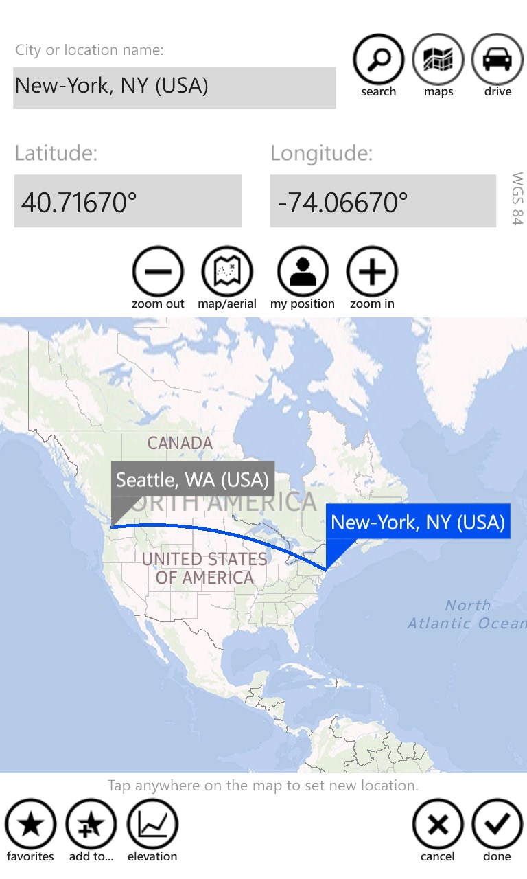
1.Obtain current coordinates, map, reverse geocode. Manage favorite locations (waypoints) and see GPS status. Manage detailed GPS settings.
2.Project. Ever wondered where you will end up if you go for 20 miles 45 degrees north? GPS Calculator can accurately project on real earth ellipsoid and provide with target coordinates. Using Bing reverse geocoding, you can also find the name of the place.
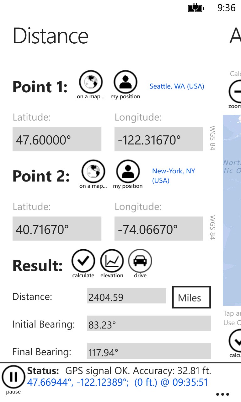
3.Measure. What is the exact distance from Berlin to London? From home to office? Wonder why planes from Seattle go to Paris over Greenland? With more than 2700 cities data build-in this function works even in offline mode. Geodesic line is visualized on a world map and shortest distance is accurately calculated using Vincenty’s formulae.
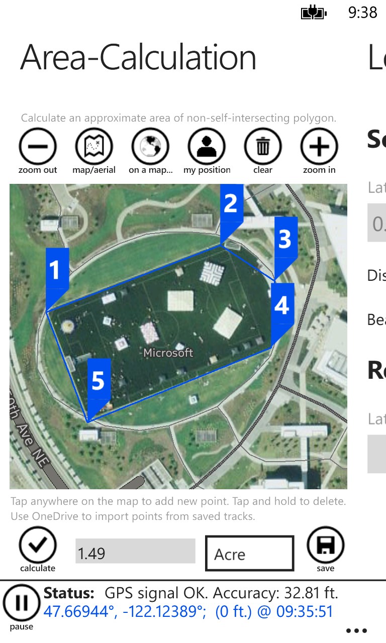
4.Calculate an approximate area of any polygon using map or aerial view.
5.Convert between different coordinate data formats. Decimal degrees, GPS coordinates, Degrees-Minutes-Seconds and UTM (Universal Transverse Mercator) are supported.
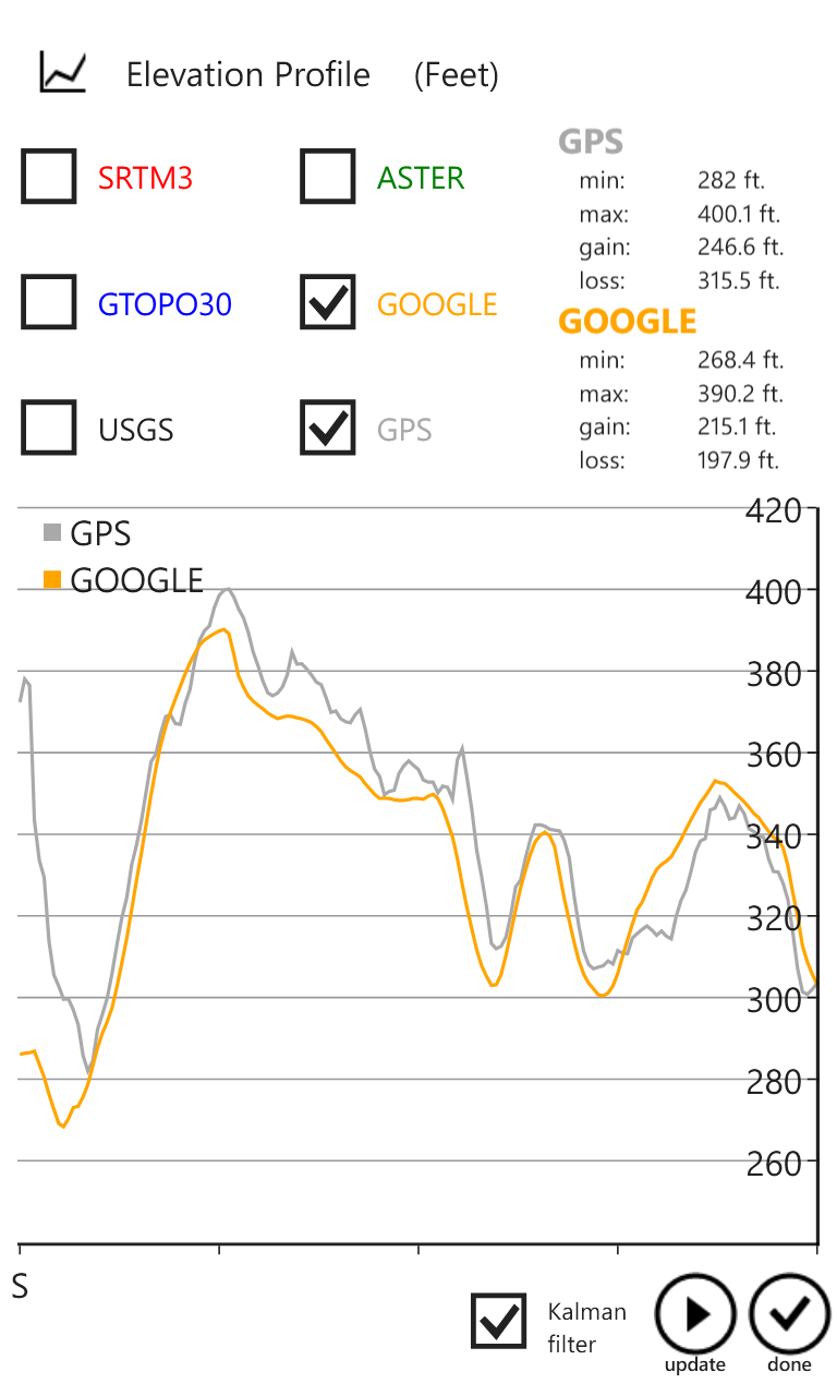
6.Altimeter allows to get accurate elevation in any given point using five different topography data sources. You can also view elevation profile of any route.
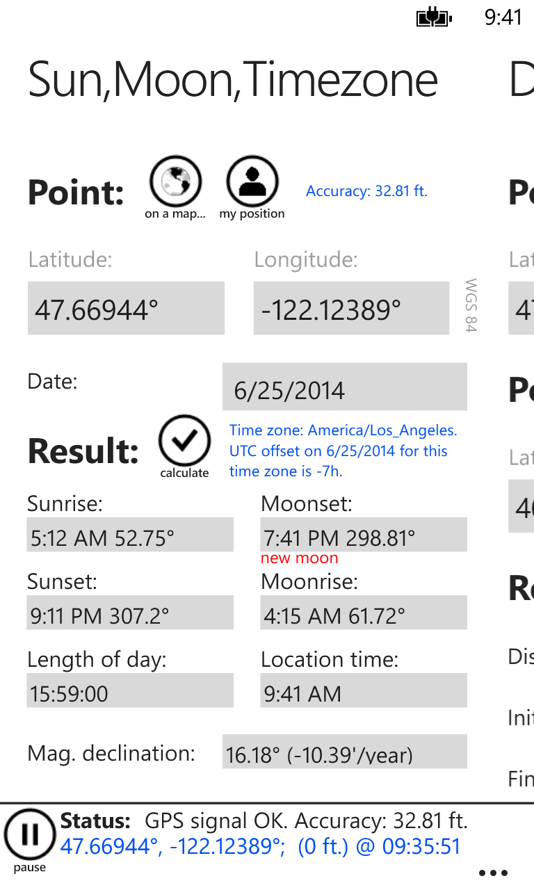
7.Time tab allows you to get time zone information, sunrise and sunset times for any date and any location on the planet.
More info:
http://en.wikipedia.org/wiki/Vincenty%27s_formulae
http://en.wikipedia.org/wiki/World_Geodetic_System
http://en.wikipedia.org/wiki/Universal_Transverse_Mercator_coordinate_system


Similar Apps View all


Comments View all

568 comment
3 July 2017
Awesome app. No need to get a GPS.
30 June 2017
Worked great for me
28 June 2017
Very useful app. I love it.
27 June 2017
Best
20 June 2017
Usefull app!
14 June 2017
It's great! Especially for my trail runs and boonie stomping.
9 June 2017
Ok:D
22 May 2017
Trop cool Hein! Surtout avec un voyage en voiture, tout est clean. Infos sur la vitesse, changement d'altitude info's en temps reel.
20 May 2017
Fun to watch and enjoy
23 April 2017
Excellent