• 0
  • 4.1
    610 total
    5
    324
    4
    143
    3
    69
    2
    39
    1
    35
  • Category: Education
  • Published by: KarhuKoti ?
  • Size: 18.2 MB
  • Permissions:
    • Access your Internet connection
    • Use your location
    • Use your webcam
    • Use your microphone
    • Use your pictures library
    • serialcommunication
    • Access to your Account’s username and picture
  • Supported processors: x86, x64, ARM
  • Language: English (United States)
  • Learn more:
  • Notes:
    * 2017 - Windows 10 Creators Update support. Road globe projection. November 2016 - Maidenhead grid square and distance between two stations and great-circle. September 2016 - Update for ISS International Space Station. July 2016 - Es'hailsat 2 pre-launch tracking. Augmented reality with Sky Locator to view satellite location with camera. March 21, 2016 - Sun orbit page back so you can see the azimuth and elevation matching the sun to the geosync satellite being tracked. March 20, 2016 - Left long press, asks, do you want to track from here? If so, put in manual mode that is in settings. March 15, 2016 - If tracking a geo sat, gives time when sun is at same longitude as satellite. March 13, 2016 - Sun icon and footprint. March 9, 2016 - TV installers like: show all geo satellites at same time, click to track. March 9, 2016 - TV installers like: show antenna direction at user location with deep zoom. March 3, 2016 - Quick satellite search field on main page. Updated DXCC entities as prefixes. Feb 29, 2016 - DXCC country icons on map and mutual visibility calculator. Oct 29, 2015 - Updated keplerian element loading to get more available satellite spacecraft. Sept 23, 2015 - Location override so you can put in your own specific location. This can be used in the field, if you do not have a GPS in your computer, or your service provider resolves to a location very far away. Sept 17, 2015 - UI formatting updates. Sept 12, 2015 - Windows 10 application.
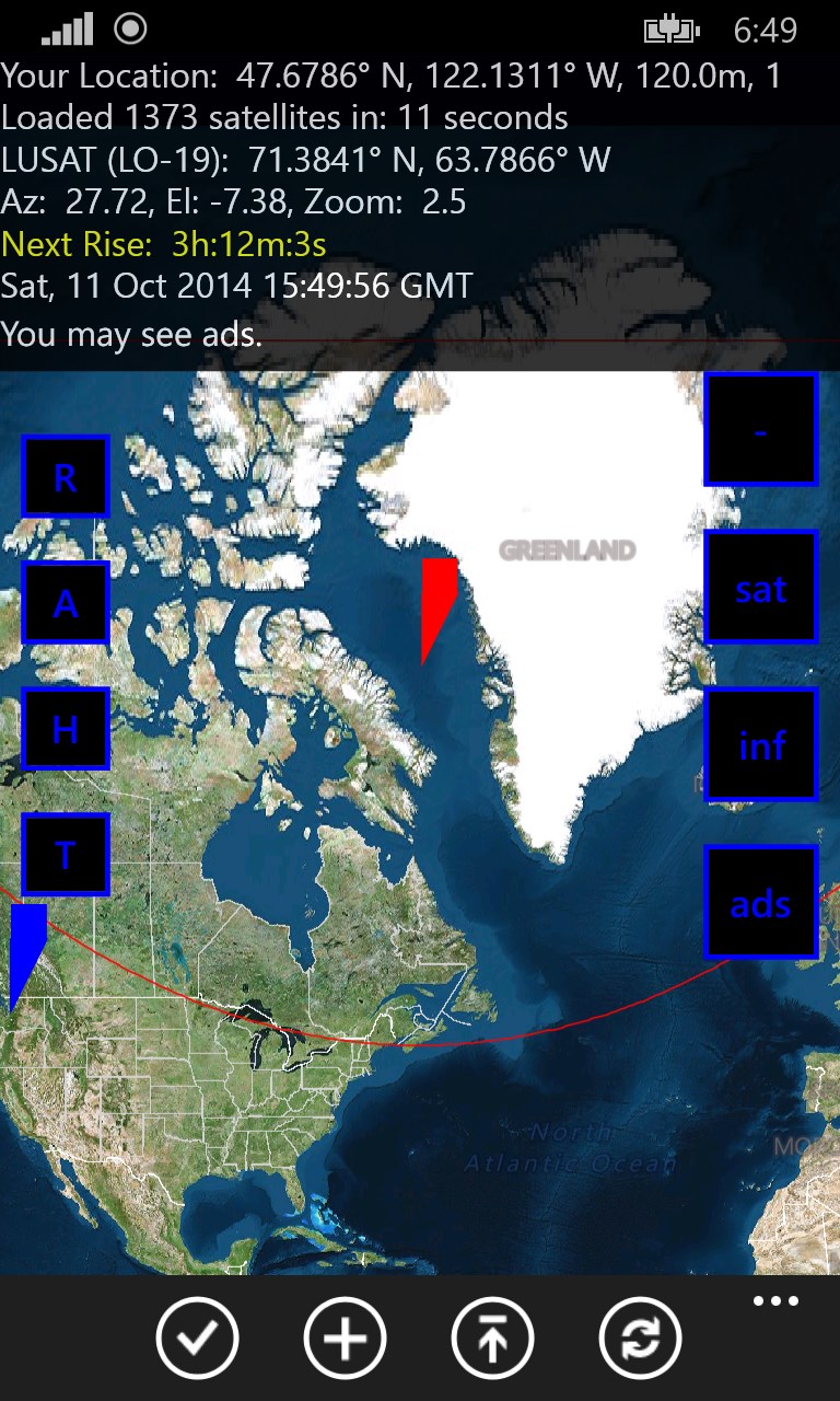
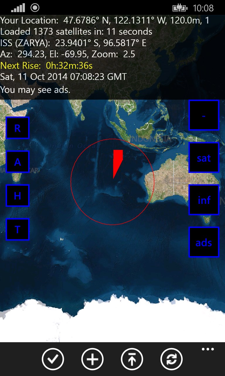
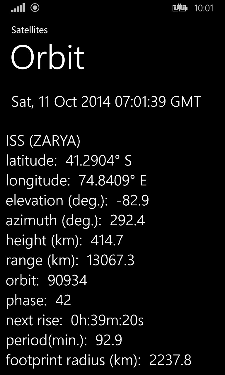
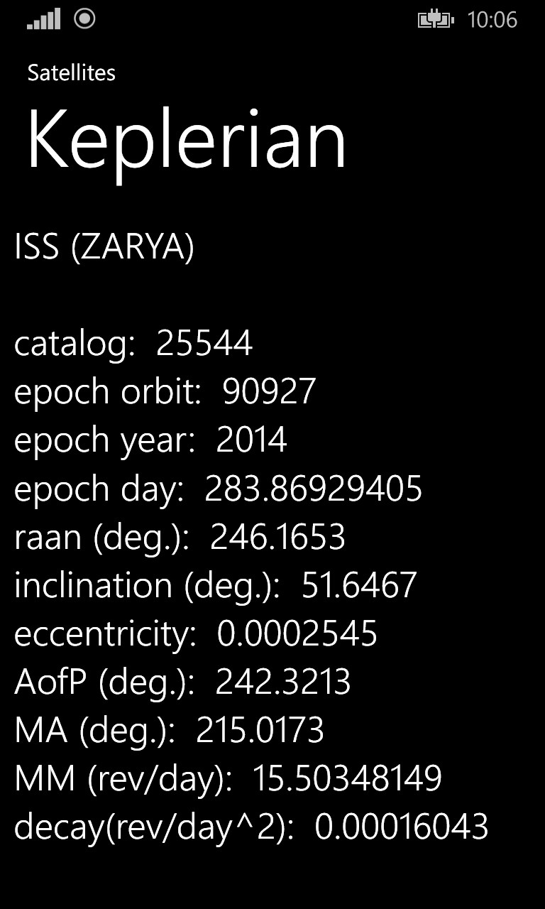
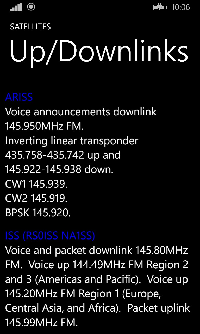
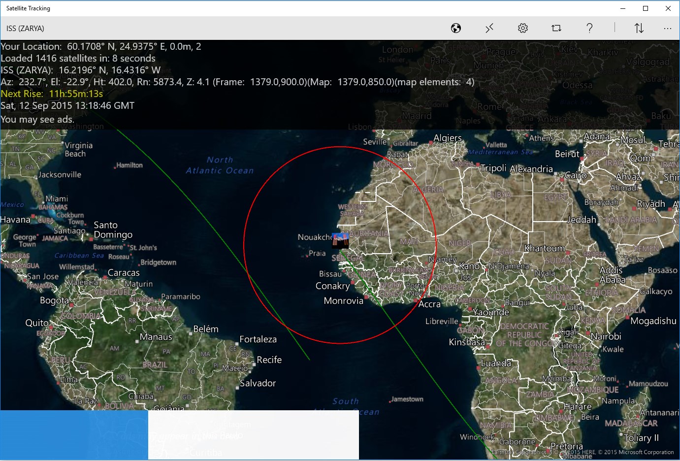
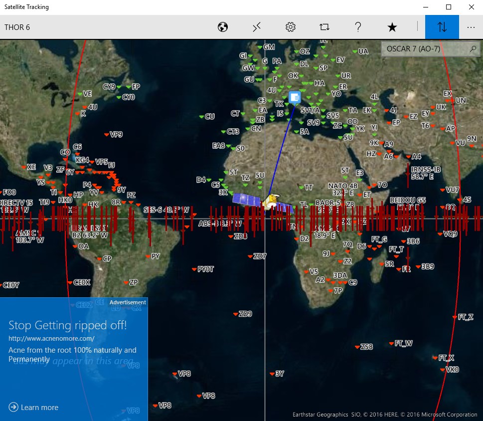
Satellite Tracking

See the location of the International Space station and all other earth orbiting satellites. Did you know the brightest man-made object orbiting the earth is the International Space Station? And, did you know it is very easily seen on a clear night? With the Satellite Tracking application, you can determine when the space station or other satellites are visible from your location for viewing or communicating. There are over 1400+ satellites currently orbiting Earth. Some of these include amateur radio, Hubble space telescope, GPS, navigation, communication, earth and science, spy, classified, scientific, plus many more! The Satellite Tracking application features include: Show all geo satellites at same time on equator - click to track Show antenna direction line to satellite - deep zoom 2D or 3D map (road, aerial, terrain) Zoom in and out on maps User and satellite position icons Satellite footprint Satellite future location GPS location service or manually entered position # of satellites loaded from the internet Satellite designator and sub-satellite position Azimuth and elevation from your position Height above earth Range from your location Countdown timer for next rise at your location GMT date display Satellite category and selection Settings for map style Setting for map centering on user, satellite, or free roaming map Location override to manually enter your position Equator, date-line, and prime-meridian lines on map Share your map and position data to popular social media and other applications registered on your system such as Twitter, mail, etc. Help documentation and tool-tips to aid in your usage Toggle switch to allow position information to be displayed on map or not for pure-view map examination Orbit information such as catalog number, latitude, longitude, elevation, azimuth, range, height, orbit #, phase, next rise, period, and footprint radius For given category, show all satellites currently in view or all Future passes showing date and time, azimuth, and elevation Radio communication frequency bands, links, and modes to use for Amateur Radio satellites Keplerian information such as catalog number, epoch orbit, epoch year, epoch day, raan right ascension of node, eccentricity, mean anomaly, mean motion, and decay rate Application details shown in about, perform an application review, ask for support if need, send feedback, or view other applications written by the authors DXCC countries can be shown on the map DXCC calculator to show what countries can be communicated to via the satellite Perhaps you want to spot the station, get current position of ISS, or ask yourself where is the international space station? The following categories of satellites can be selected: Amateur Brightest Communication Earth-weather Geo-sync Miscellaneous Navigation New Old Scientific Stations These are just some of popular satellites to track: Amateur OSCAR 7 (AO-7) UOSAT 2 (UO-11) LUSAT (LO-19) EYESAT-1 (AO-27) ITAMSAT (IO-26) RADIO ROSTO (RS-15) JAS-2 (FO-29) TECHSAT 1B (GO-32) ISS (ZARYA) FUNCUBE-1 (AO-73) UWE-3 SPROUT DUCHIFAT-1 CHUBUSAT-1 NUDT-PHONESAT XW-2A XW-2B XW-2C XW-2D XW-2E XW-2F LILACSAT2 DCBB AO-85 FOX-1A Brightest ATLAST CENTAUR 2 THOR AGENA SL-3 SL-8 R/B CUSAT 2 & FALCON 9 R/B Communication MOLNIYA O3B Earth-Weather NOAA GOES TDRS SCD HST Hubble Space Telescope METEOSAT Geosynchronous DIRECTV SKYNET INTELSAT NATO OPTUS ASTRA AMSC ECHOSTAR MSAT PALAPA Eshailsat INMARSAT EUTELSAT GALAXY SUPERBIRD BRASILSAT CHINASAT THOR SIRIUS AFRISAT ASIASAT TELKOM HISPASAT ASIASTAR TURKSAT SAUDISAT SPACEWAY BADR FENGYUN ZHONGXING Misc. CALSPHERE LCS OPS FLOCK CENTENNIAL New EXPRESS GAOFEN 2015-49A Old ATLAS CENTAUR 2 THOR SL-3 R/B Scientific STARLETTE HST MMS Stations ISS International Space Station ZARYA Enjoy the galaxy and look for those shooting-stars as all kids do! Privacy Policy: Location data is stored within the application and is only used for satellite position calculations. You can turn off usage of your position in settings. Functional Policy: Accuracy of positions calculations are not guaranteed.

Features:

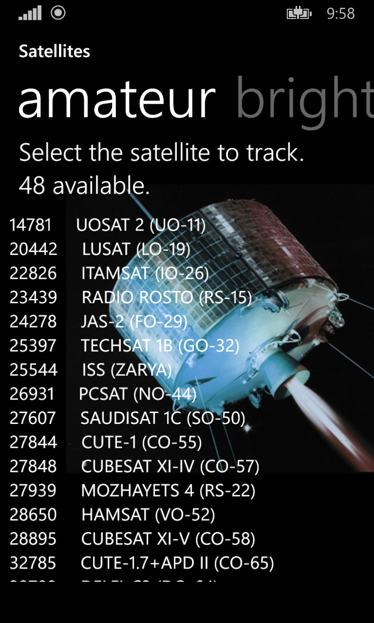
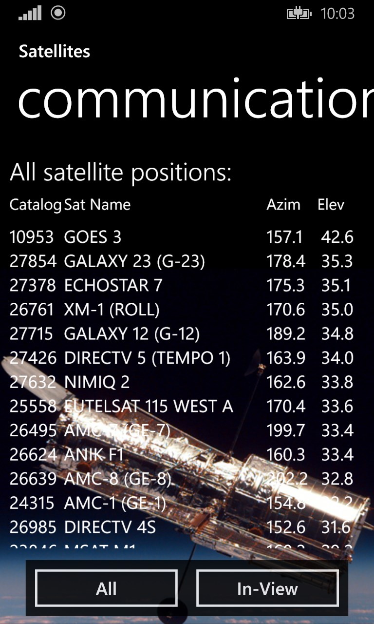
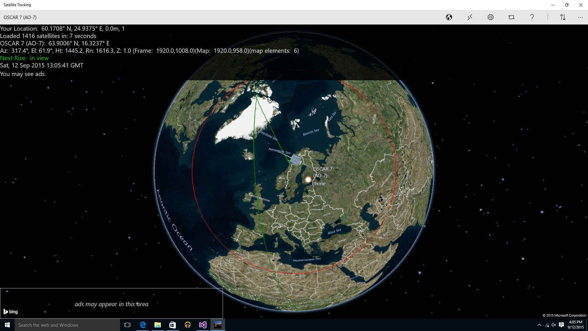
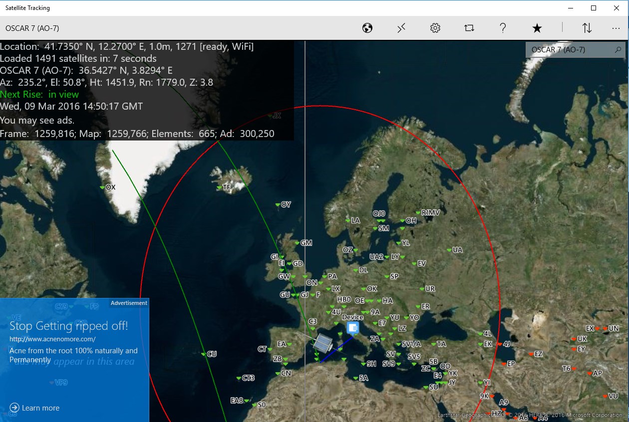
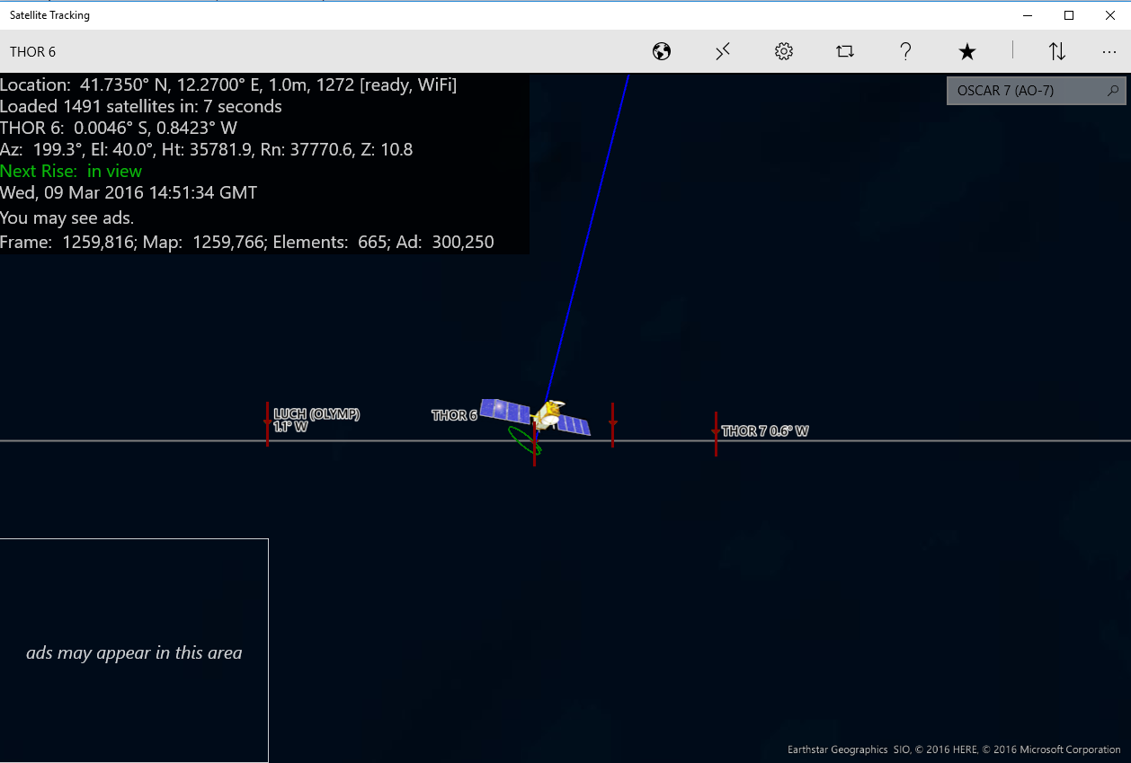
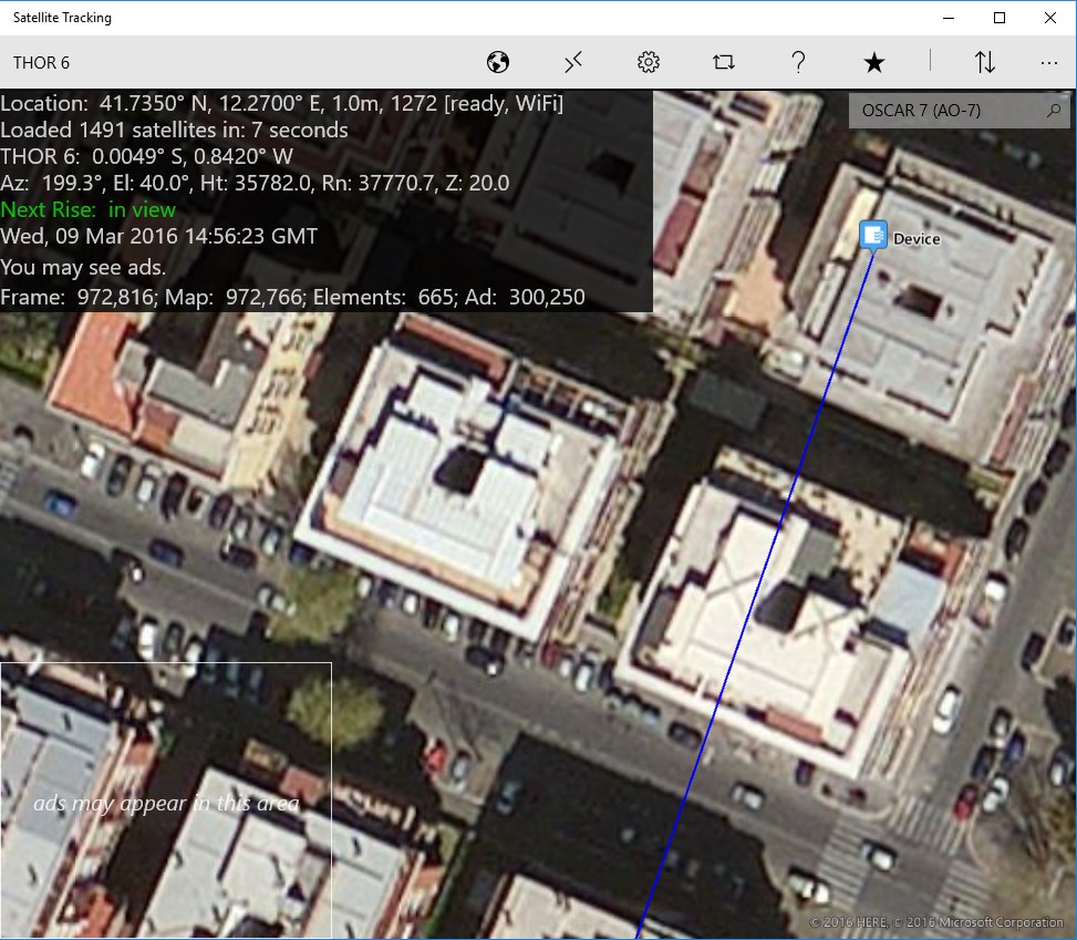
  • realtime satellite tracking of over 1400+ orbiting satellite objects
  • amateur radio satellite tracking for communications
  • determine when the International Space Station (ISS) is in view
  • determine when you can talk with the astronauts or cosmonauts
  • DX, NOAA, Spy, GPS, geo tracking, space communications, NASA, astronomy

Comments View all

234 comment


avatar

9 July 2017

I love the way you created this app. I just think like google earth it should have a flat ground feature that you can look at your location just as we do as humans. from the ground level view.


avatar

8 July 2017

Very well done!


avatar

7 July 2017

Top


avatar

7 July 2017

I love this app it is great because it tells you the name of each and every satellite and the down side is it is a little tricky with the controls but it is great once you get the hang of it


avatar

4 July 2017

100%


avatar

16 June 2017

This morning I saw it


avatar

15 June 2017

The "sky locator" not working ☹ When I trying to use sky locator part, app crash and closed.


avatar

11 June 2017

A lot of informations you ever need


avatar

5 June 2017

I have been using this app for The International Space Station and it's very accurate with another webpage showing the exact location : )


avatar

22 May 2017

Cool but I don't know how to use it

Load more