- Like Collect Share
-
0 0
- Category: Navigation & maps
- Published by: kitya
-
Permissions:
- Use your location
- Use your device network services
- Use your maps
- Supported processors: x86, x64, ARM
- Language: English (United States), Japanese, Russian
- Learn more:
-
Notes:
* 1.4. Minor bug fixes. 1.3. Japanese language translation by Ekaterina Bespyatova. SIRGAS 2000, SAD 69, Córrego Alegre, SICAD and Astro Chuá Brasil/South America datum support. PLSS (Public Land Survey System) support. 1.2. RT 90 and SWEREF 99 Swedish national grids and relevant datums. Share location function (sms, email, social networks). Force update check function. View location on the build-in maps app function. 1.1. Altimeter service (available as an optional download) and various small bug-fixes.
Maps Tool
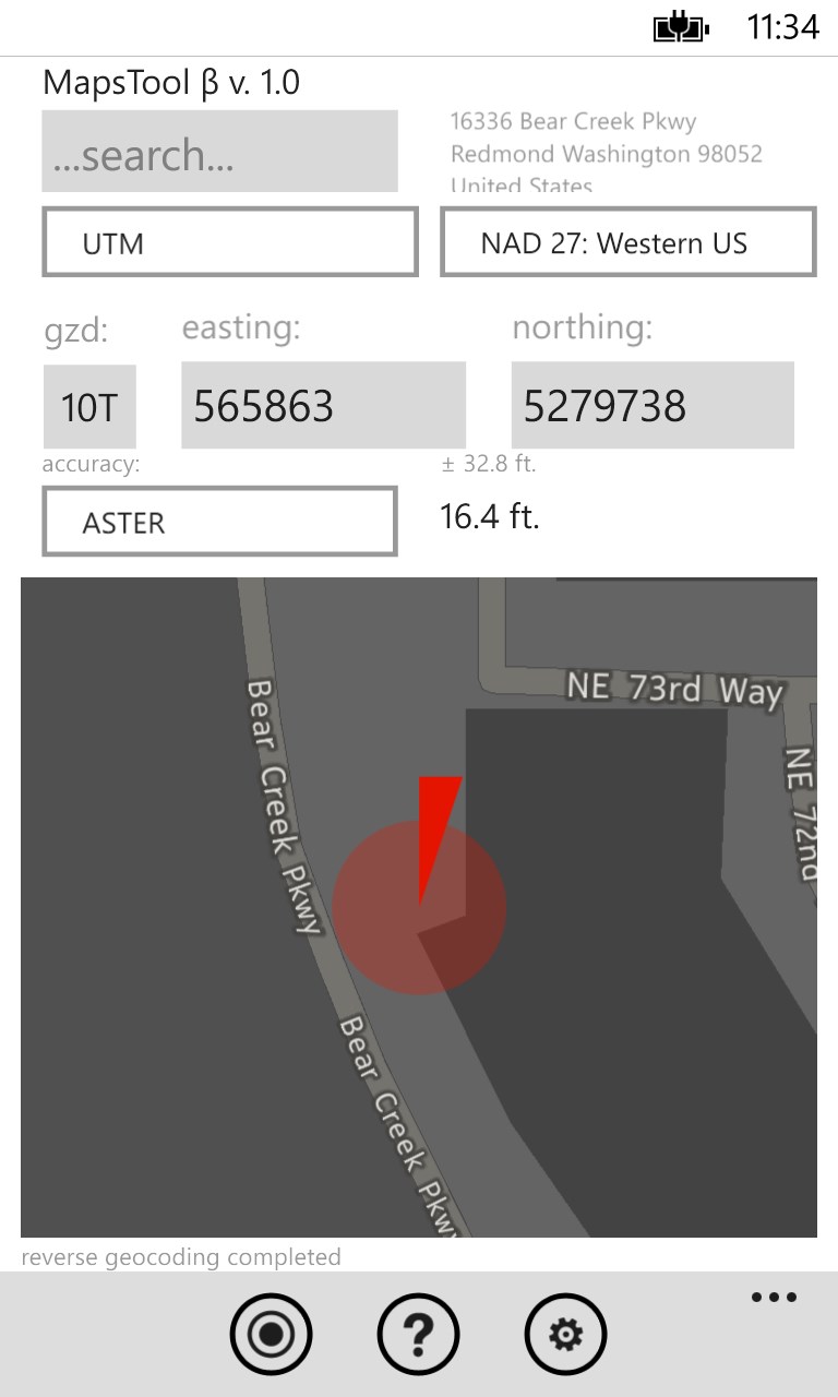
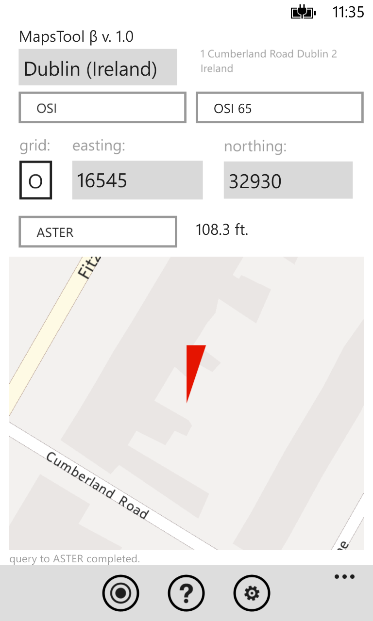
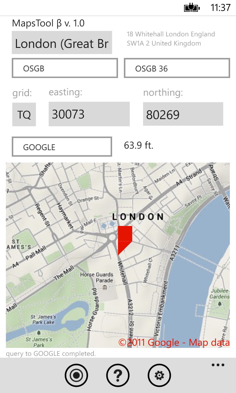
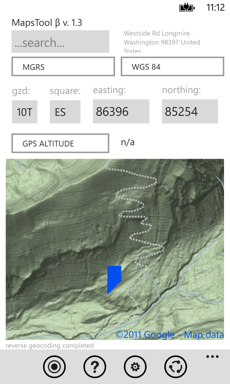
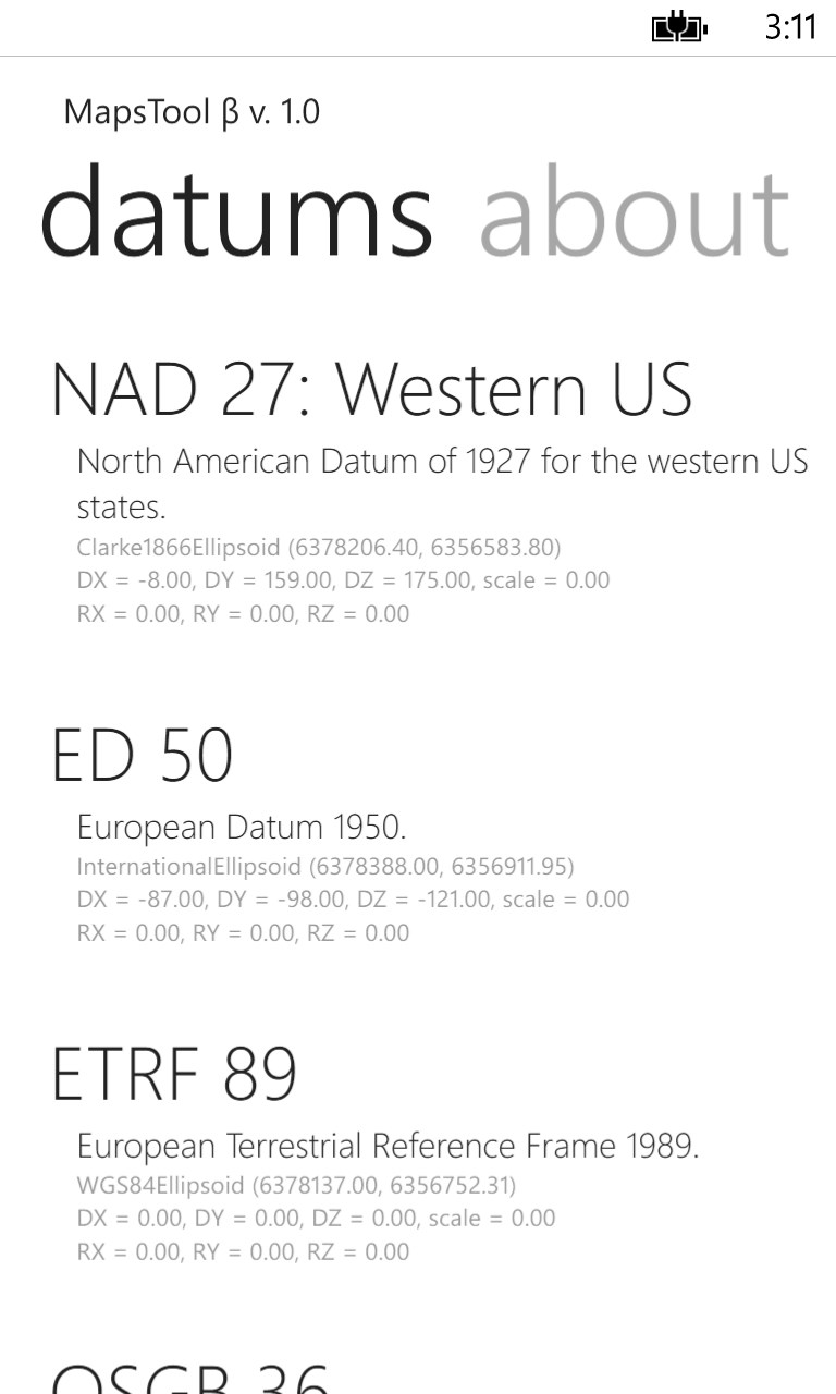
Maps Tool is a powerful app that allows you to convert data between many coordinate system representations and also adjust for various datum. This app currently supports lat/lng, UTM, MGRS, Earth-centered, Earth-fixed Cartesian coordinate system, Swedish Grid, Ordnance Survey of Great Britain and Irish National Grid and many different geodetic datums, including, but not limited to: WGS 84, NAD 27, ED 50, ETRF 89, OSGB 36, OSI 65, RT 90, SWEREF 99, SIRGAS 2000, SAD 69, Córrego Alegre, SICAD, Astro Chuá and SK 42.
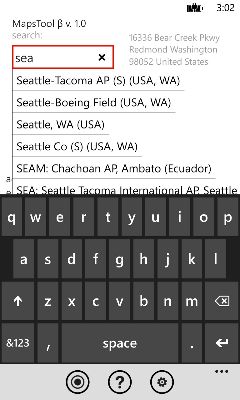
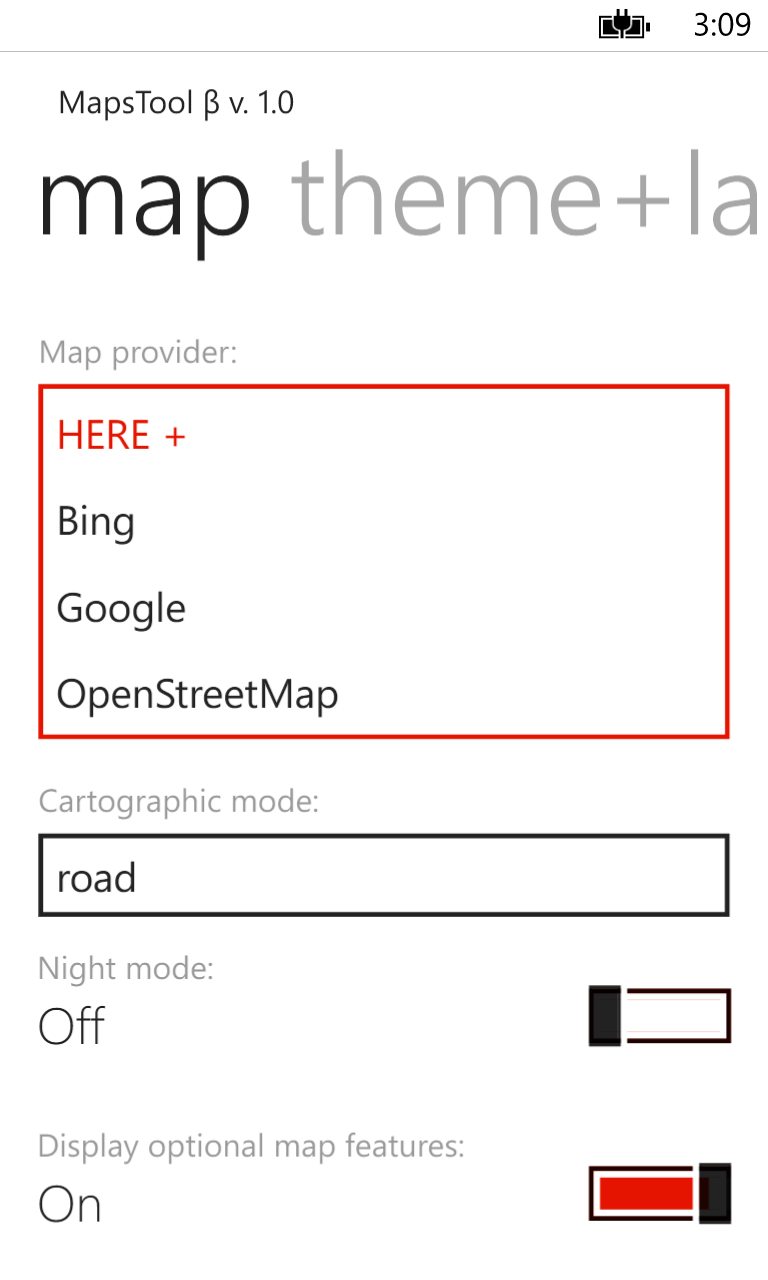
By default Maps Tool uses offline HERE+ maps already stored on your phone, but can also use Bing Maps, Google Maps, and OpenStreetMaps for better coverage. Overlays such as topographic map and satellite imagery are also available. Other handy function of Maps Tool include geocoding (finding location by address) and reverse geocoding (find closest address for a given location), sharing your location via sms/email and build-in database of around 3000 major cities and 9000 world airports for quick access (you can just key in a 3-letter IATA or 4-letter ICAO code).
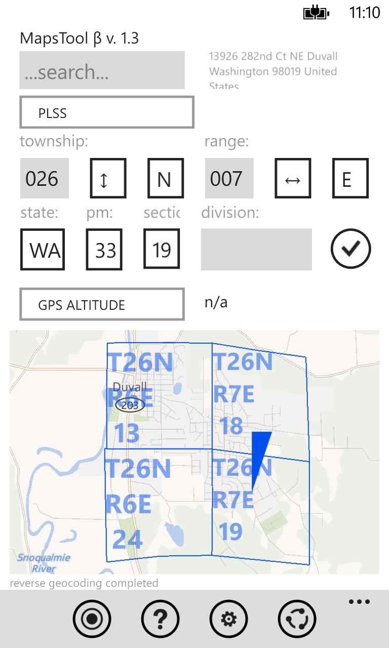
Using web service from BLM (Bureau of Land Management) Maps Tool also gives you access to PLSS (Public Land Survey System) information (township, range, section) as a convenient map overlay (you can search for parcels by TRS or view parcels around you by tapping on the map).
Last but not least, Maps Tool app allows you to see rough altitude information from the GPS module in your phone, or (available as an optional download) query various GIS systems for accurate topographical altitude information including currently supported: USGS (US only), SRTM3, GTOPO30, ASTER and Google.
Best of all this app does not require a data connection to work, so you can take it with you into the field.
Similar Apps View all


Comments View all

46 comment
30 June 2017
Karaj iran
6 May 2017
Please universal
18 January 2017
Great app for military land nav.
5 November 2016
Quite useful app.A little above average learning curve; but if you stick with it it's a good tool. Thanks for developing it.
26 September 2016
Like it alot. Thank you
22 September 2016
useful and adaptable to different situations.
1 September 2016
Useful tool for the arsenal!
31 July 2016
Great job on the app. Really useful. Thanks!
21 June 2016
Great app.
19 June 2016
Great app, used in the last more times than I can count!