- Like Collect Share
-
0 0
- Category: Education
- Published by: HPB-Labs ?
- Size: 41.9 MB
- Supported processors: x86, x64, ARM
- Language: English (United States), Spanish, Italian, Portuguese, French, German
- Learn more:
-
Notes:
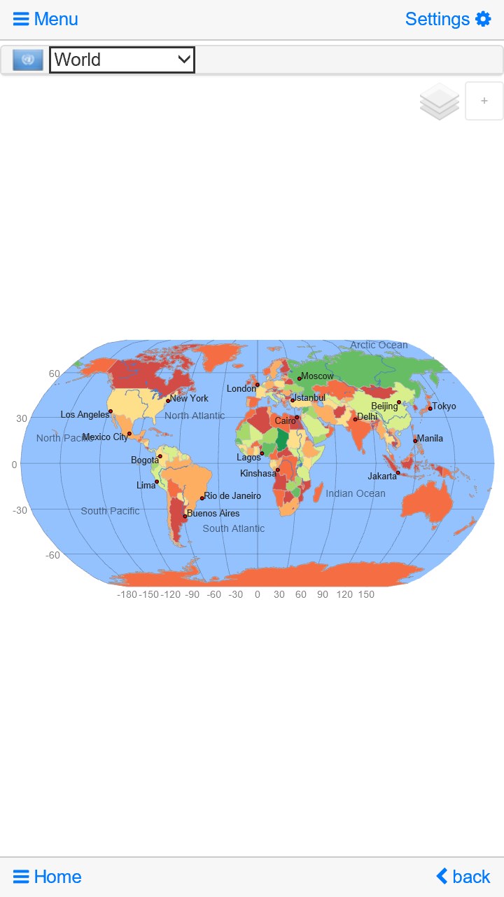
* Maps: enhanced zoom for shaded relief layer • Lists: keeping of last scroll position • World-clock: now sortable • Advanced search added, search by capital city, iso, dial code … • Maps: updated maps for small countries and islands • Maps: enhanced performance for zoom and pan • Quiz: improved game play and optimized user interface • Quiz: fixed bug in the mountain quiz
World Atlas & Quiz MxGeo Free
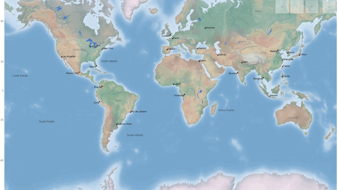
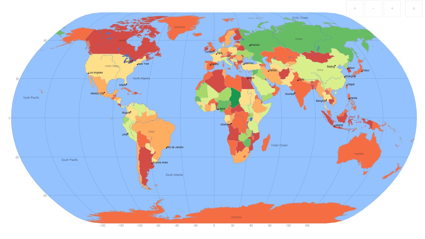
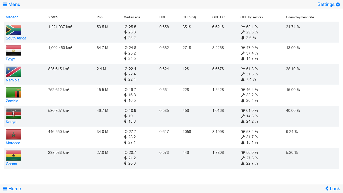
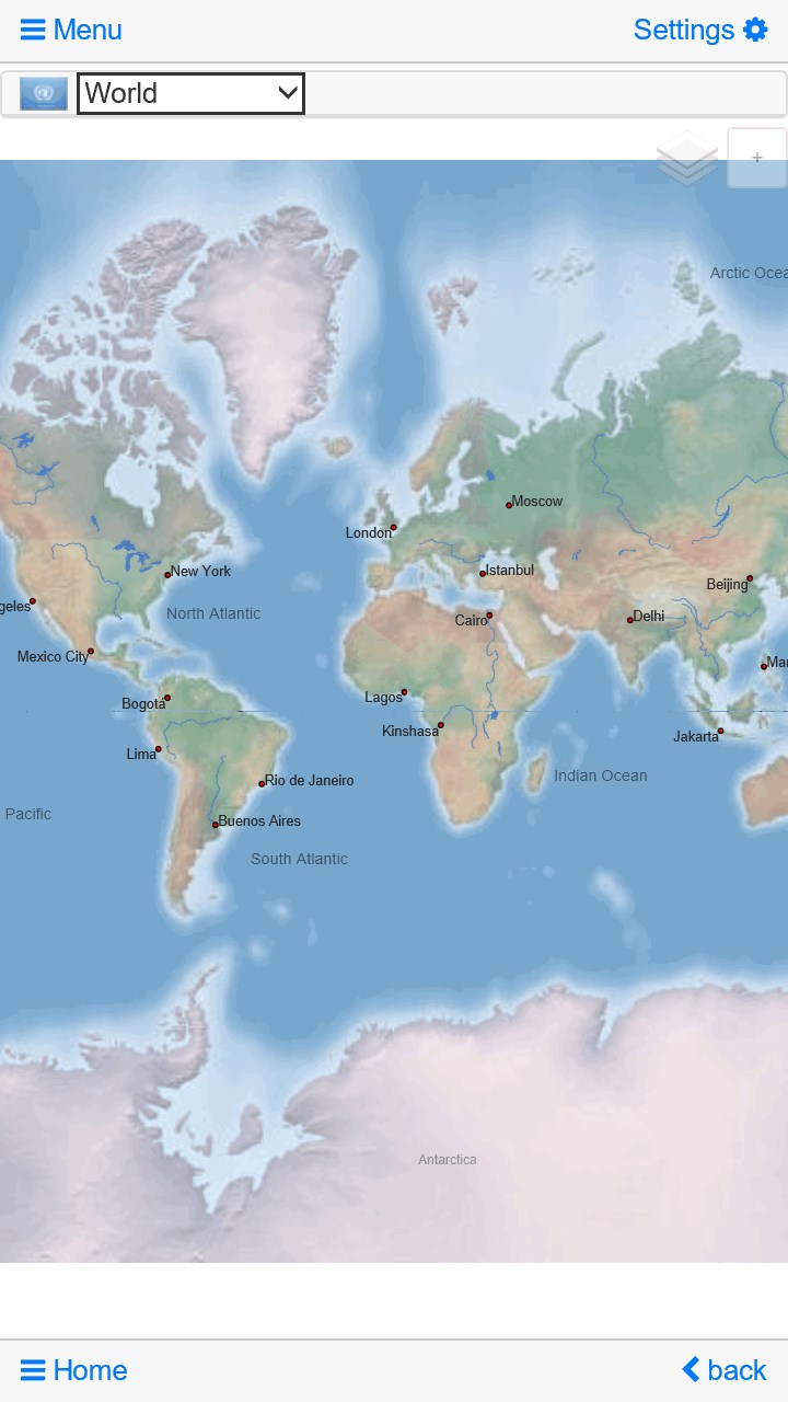
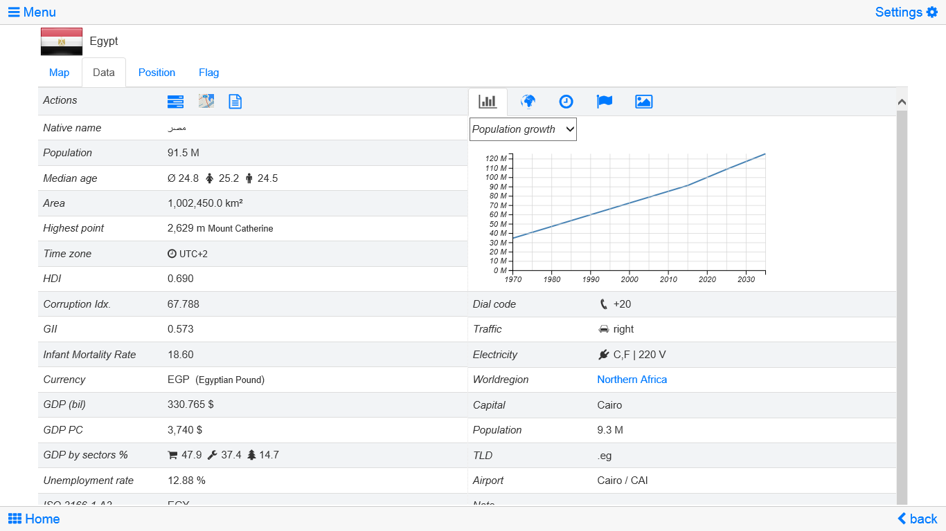
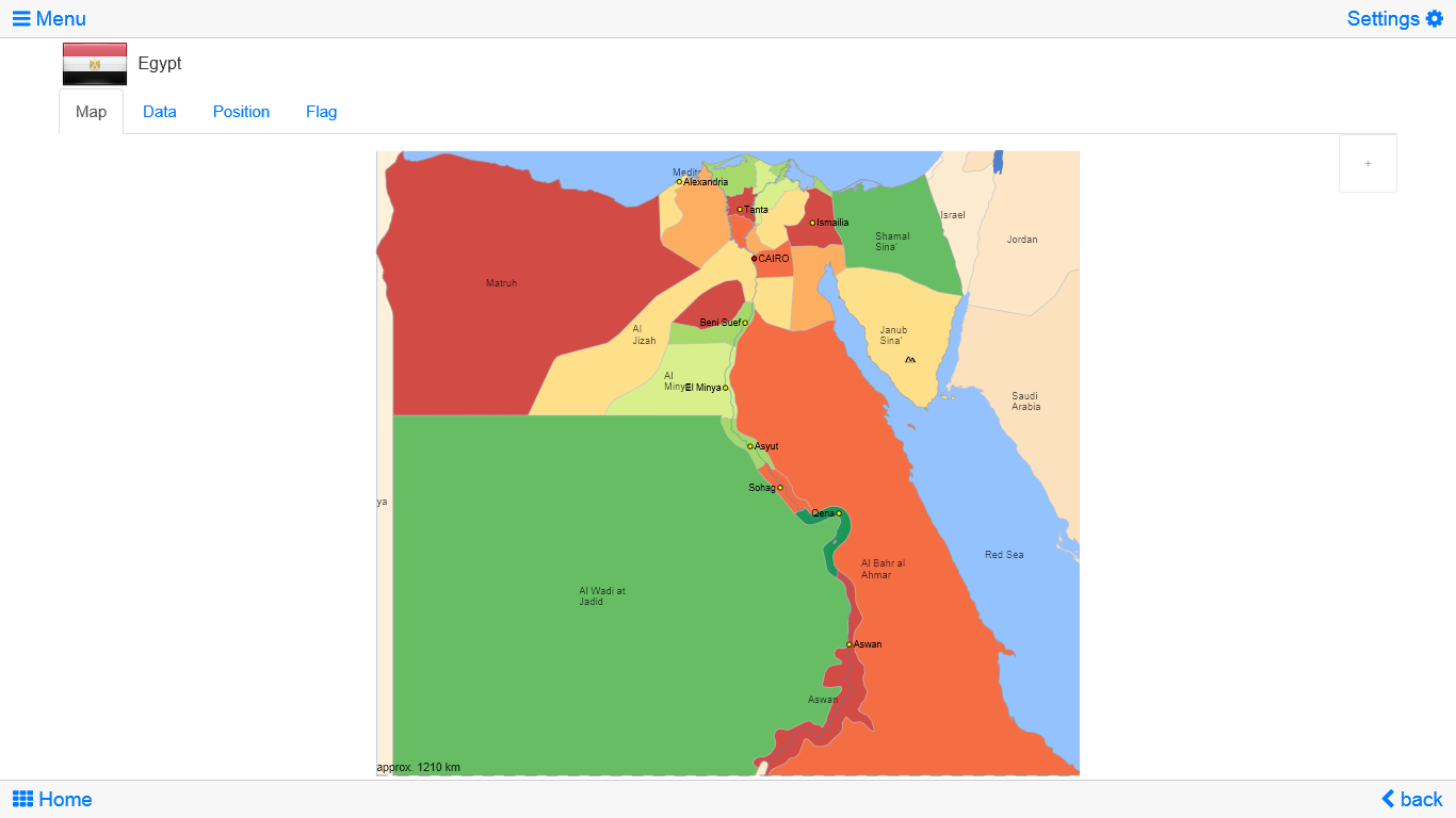
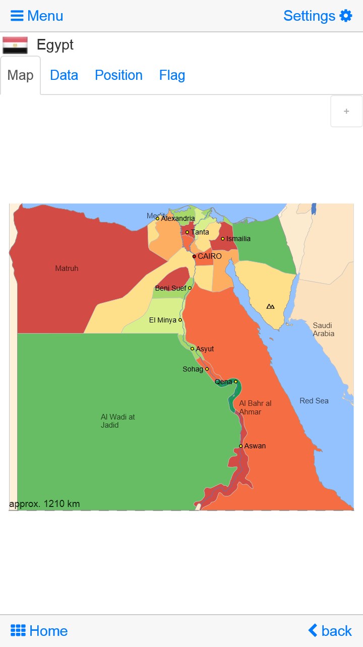
World atlas, world map and educational app for geography. Flags, position maps and basic data for 240 countries and territories of the world. Political maps with regional units and comprehensive economic and statistical country data for all African countries.
Designed for desktops, smartphones and tablets.
• Flags, position maps and basic data for 240 countries of the world
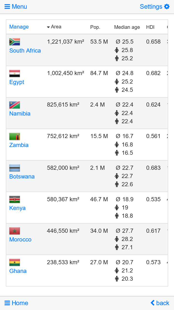
• Political maps and comprehensive data of all African countries
• Interactive political world and continent maps
• Shaded relief layer for world and continent maps
• Geography quiz challenge for playful learning
• Country comparison and favorites
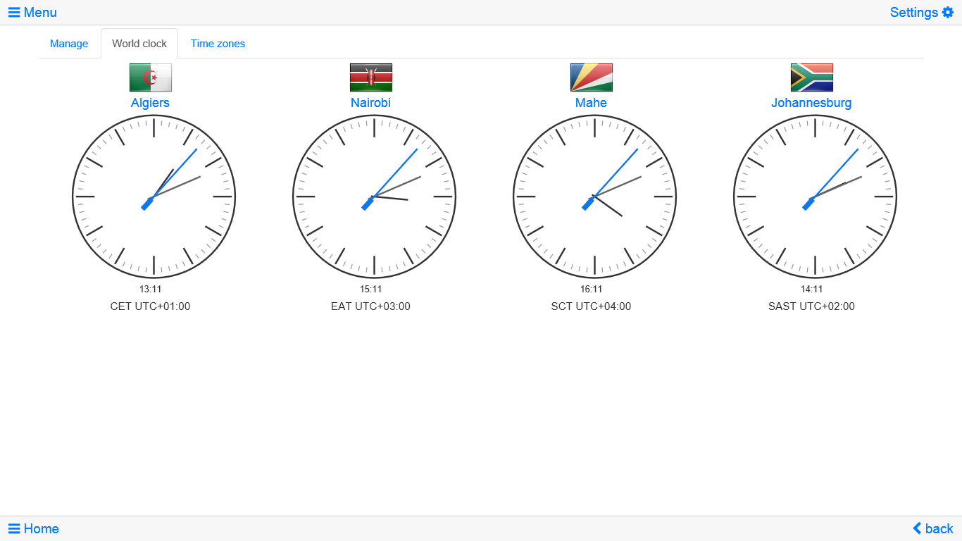
• World clock with time zone display
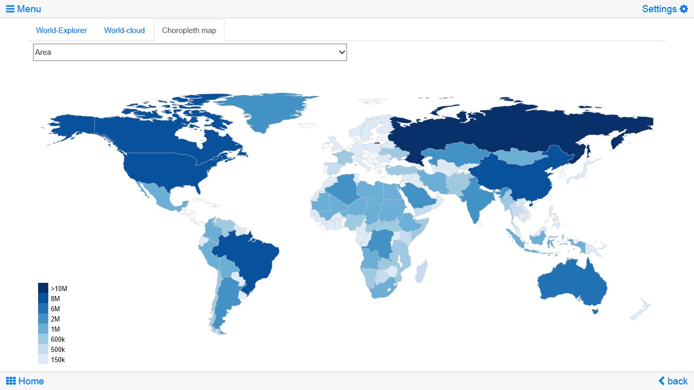
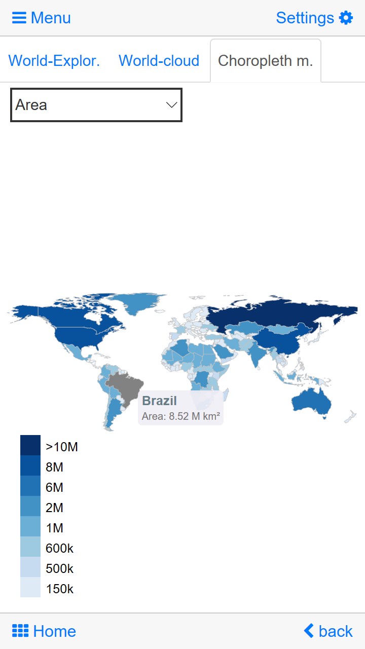
• World-explorer: the smallest, largest, wealthiest, ... countries
• No online connection required
• No advertising or In App Purchases
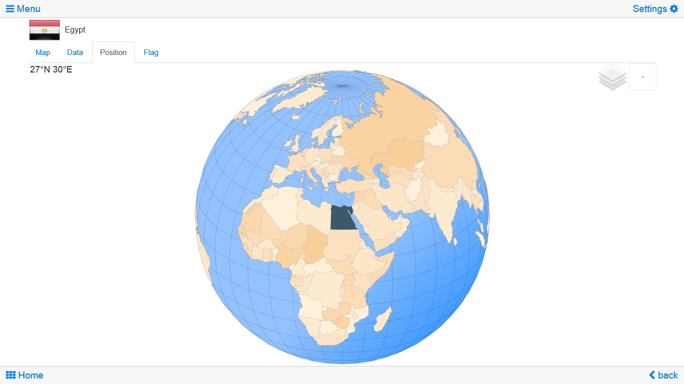
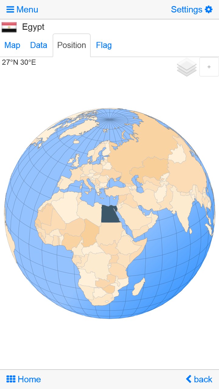
Explore the world by political world and continent maps offline maps. Learn where each country in the world is located. View its position highlighted on a digital globe. Create your favorite color theme or choose from different color schemes for map display.
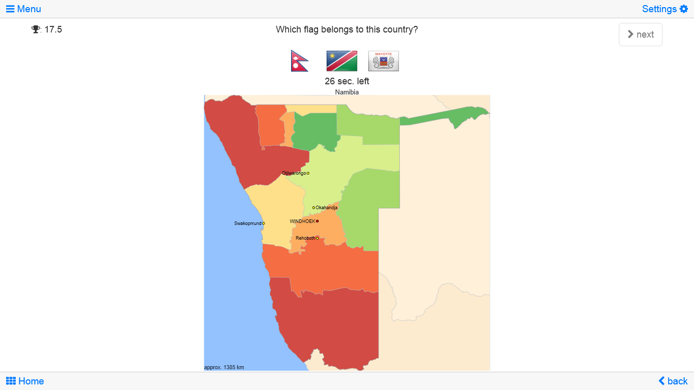
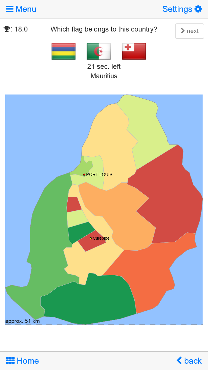
Do you know the flag of Zambia? Yes? Perfect. Do you also know in which country Mount Kilimanjaro is located? “World atlas & world map MxGeo Free” Quiz helps you acquire a geographic literacy in a playful manner.
Choose from six geo guessing games:
• Test your knowledge about the capitals of Africa
• Do you know the ISO countries codes?
• Recognize the proper country flag based on the outline map
• Do you know the top-level domains of each country?
• Guess the highlighted country on the virtual globe
• Do you know the mountains of Africa?
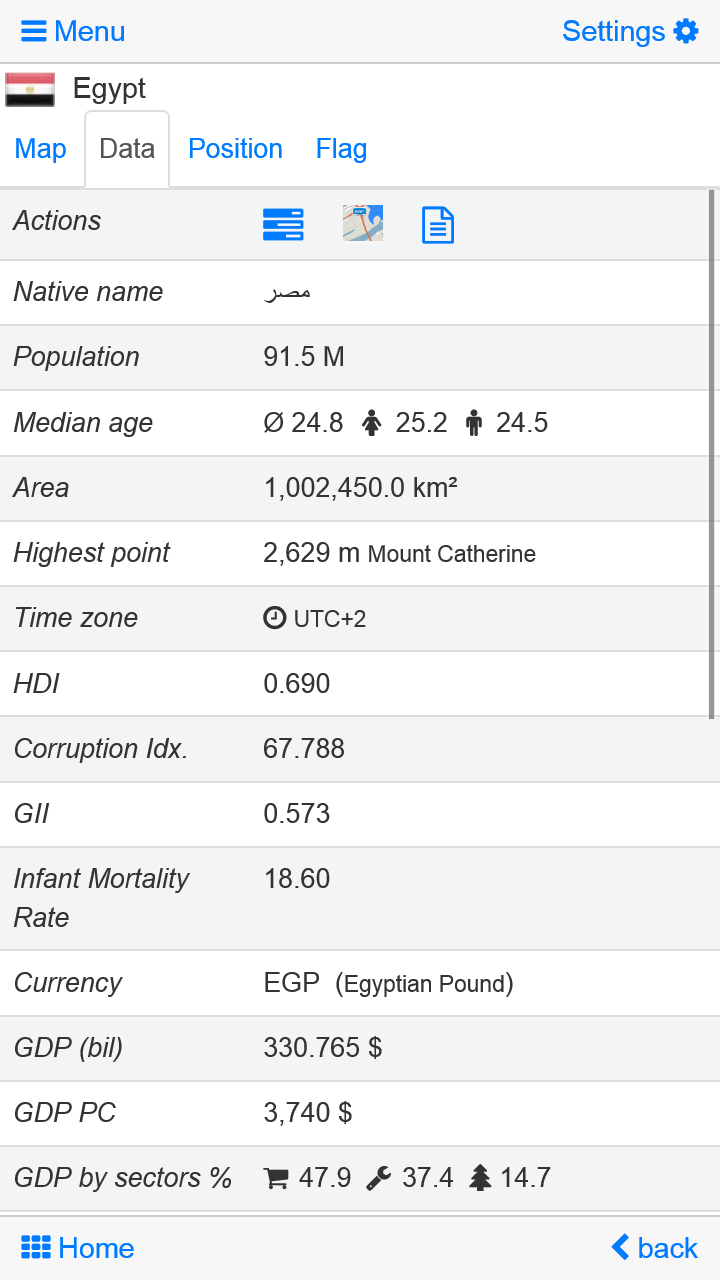
Geo learning app and educational game which is fun for everyone whether children, adults, seniors or teachers. Get ready for your next stay abroad while enjoying this great world almanac including time zones and statistical data, such as population growth, unemployment rate, average age, gross domestic product (GDP) by sector and other key figures. Or prepare for your next geography lesson with this genius digital world map. If not traveling our world atlas lets you explore the world just only virtually.
Free version includes comprehensive data and political maps for all African countries. Get “World atlas & world map MxGeo Pro” with data and maps for 240 countries and territories of the world: Europe, Asia, North America, Africa, Oceania and South America.
Features:
- Flags, position maps and basic data for 240 countries of the world
- Political maps and comprehensive data of all African countries
- Interactive political world and continent maps
- Geography quiz challenge for playful learning
- Country comparison and favorites
- World clock with time zone display
- World-explorer: the smallest, largest, wealthiest, and most populated countries
- Virtual Globe quiz for 240 countries and territories
- No online connection required
- No advertising or In App Purchases
Similar Apps View all


Comments View all

2 comment
28 August 2016
It is very helpful!
4 May 2016
good app to learn.