- Like Collect Share
-
0 0
- Category: Navigation & maps
- Published by: Simon McKenzie
-
Permissions:
- Use your location
- Use your device network services
- Use your music
- Use the media items that are currently playing
- Use any of your Windows Phone sensors
- Access your browser
- Use the photos in your media library
- Use your media library
- Supported processors: x86, x64, ARM
- Language: English
- Learn more:
-
Notes:
* Added protection against corrupted track log data encountered during load
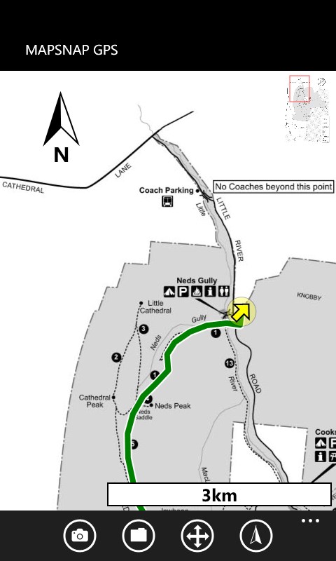
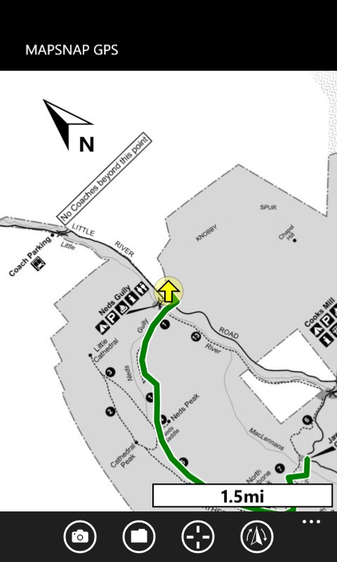
Mapsnap GPS
Features:
- Allows you to photograph a physical map or use any image as a moving map
- Shows your current GPS map position in real time
- Adds a dynamic scale indicator (kilometres or miles) and a north indicator to every map
- Can rotate maps to north, to your current bearing, or to true north (using the compass)
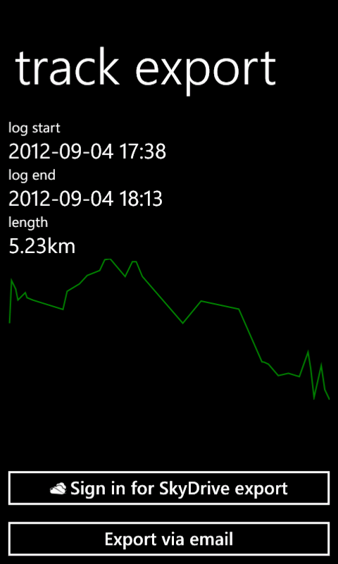
- Supports SkyDrive/email GPX path export for upload to sites like Google or Bing maps
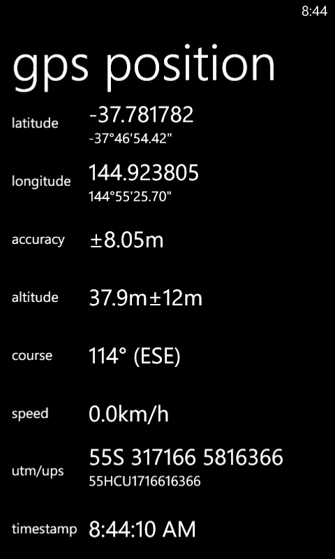
- Has a realtime GPS dashboard
- Can run under a locked screen
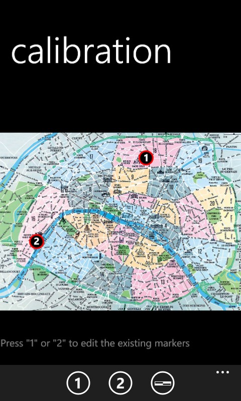
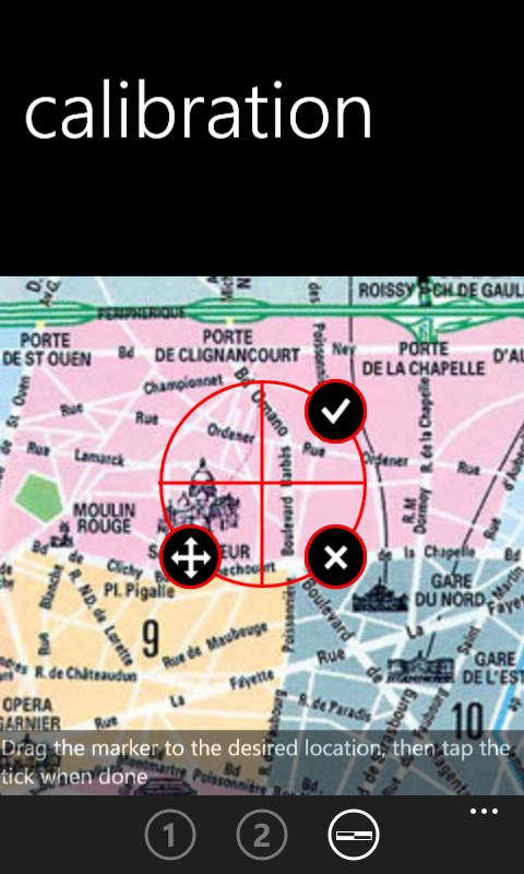
- Automatically saves "snapped" maps and calibration data for every map you've used
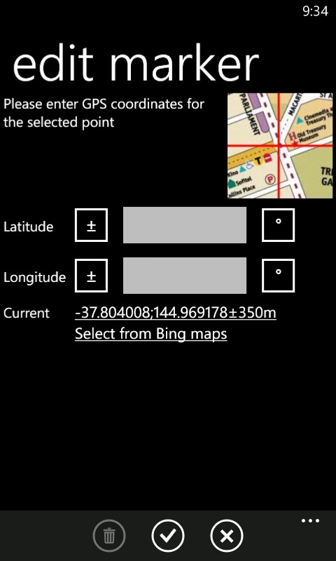
- Supports latitude/longitude, UTM/UPS, and MGRS georeferencing
- Doesn't require a data connection for navigation - all maps are stored offline
- Has a deep zoom function, perfect for fine details in scanned maps
- Is great for trailhead maps and corn mazes!
- Can load GPX files as "guide" routes
Similar Apps View all


Comments View all

42 comment
2 June 2017
Use it all the time on hikes - nice to have GPS on a picture of a map when needed. Keep it up!
7 January 2017
I know this is beta, but five stars. Tried it out on a small city map I photographed from a state highway map. Worked like a charm. Some suggestions: - flatten out photographs (like Office Lens app) would be really useful - color would be nice Other than that, perfect so far!
30 July 2016
It would be great to bring create a UWP for on the PC
30 July 2016
I can't believe no one else thought of this! It's great!
9 February 2016
Easy to use and affordable.
21 January 2016
Bout time I reviewed. I use this app every time I'm off trail in the backcountry, importing my own custom maps. Calibration is spot on and the whole experience is superior to my old gps. Very little battery drain to my phone.
25 November 2015
Good work, Simon!
15 October 2015
Awesome
12 October 2015
I don't get to use this app often enough but this past weekend I used it quite a lot and it was great! Calibrating a map image before heading out onto the trails is so easy and accurate.
4 June 2015
Elegantly simple! This app does one thing and does it very well.