• 0
  • 4.7
    724 total
    5
    544
    4
    142
    3
    25
    2
    1
    1
    12
  • Category: Navigation & maps
  • Published by: stefano64
  • Size: 16.2 MB
  • Permissions:
    • Access your Internet connection
    • Use your location
    • Use your devices that support the Human Interface Device (HID) protocol
    • Detect the current motion of your device
  • Supported processors: x86, x64, ARM
  • Language: English (United States), Italian, Spanish, Portuguese (Brazil), Portuguese, Spanish (Spain)
  • Learn more:

GPX viewer and recorder

This app is the windows 10 version of "Gps navigator recorder" (more than 300.000 download in one year). https://www.microsoft.com/en-us/store/apps/gps-navigator-recorder/9nblggh2vvj3 With this app you can view GPX files (routes, tracks, point of interest) on a Windows 10 pc. If you use a smartphone, you can also follow you and draw the route on the map, then save it in the device. THIS WAY YOU CAN RECORD A TRACK THROUGH YOUR SMARTPHONES, AND THEN VIEW IT ON YOUR PC LARGE SCREEN. You can import/export a local file (track route) in the documents folder of the device. You can also view a previously recorded GPX file or create a new one. You have four modes of operation. 1) The first is a simple compass synchronized with map. You can disable this feature in the settings page "Synchronize map with compass (when follow or play is unactive)". If the option is checked the map rotate with you, otherwise the map is always facing north. 2) Follow me and draw route on the map. In the menu you must click on "Start follow me / Stop follow me". This feature is enabled when the option "Enable track route on map" in the settings menu is checked. When you stop the function clicking on "Stop follow me" , the route will be stored in the device. This way, if you go from point A to point B, you can record the route. 3) Follow me and don't draw route on the map. In the menu you must click on "Start follow me / Stop follow me". This feature is enabled when the option "Enable track route on map" in the settings menu is not checked. When you stop the function clicking on "Stop follow me", the route will not be stored in the device. This way, if you go from point B to point A, you can follow a route on map previously stored and loaded (follow back). 4) Replay route on the map (a route previously stored in step 2). In this way, when you are at home, you can replay a travel. Seeing the params as (course, speed, altitude). If you are a tourist, this app will be useful to the holidays and leisure time. Or on your travels to discover places or touristic city. Or car tracks gps - cycle tracks gps - running tracks gps ☺ Version 2.0.0.0 - Bug fix Version 1.7.1.0 - Bug fix Version 1.7.0.0 - In the page map you have a slider, and through it you can select the position on map. You have also a button to show Panoramio Photo (if it is present). Bug fix Version 1.6.0.0 - In the page map you have a slider, and through it you can select the position on map. You have also a button to show Google Street View (if it is present). Bug fix Version 1.5.1.0 - Bug fix Version 1.5.0.0 - On the map page (if you are on a desktop device), you have also an altitude chart. When you replay a route, you have an indicator of the current altitude. You can enable / disable in the settings page. Bug fix Version 1.4.0.0 - Added altitude charts. In detail page added: elevation gain departure / arrival, elevation gain min / max. In the map page (on desktop device and screen more than 1150px) you can see also some altitude data. Bug fix Version 1.3.0.0 - Upload a GPX file on STRAVA. Bug fix Version 1.2.0.0 - Improved support for file "multi-segments". Added maps: OpenStreetMap, OpenCycleMap, HikeBike. Traffic information on map. Added language Spanish and Portuguese. Bug fix Version 1.1.0.0 - Bug fix Features 1) .gpx files viewer 2) Gps navigation 3) Track your route on map 4) Follow me on map 5) Replay a route previously stored 6) Save the route in your device 7) Import/export a local file in Documents folder 8) Car tracks gps / Cycle tracks gps / Running tracks gps 9) Motion data 10) Traffic map layer 11) Maps: OpenStreetMap, OpenCycleMap, HikeBike 12) Upload a GPX file on STRAVA

Features:

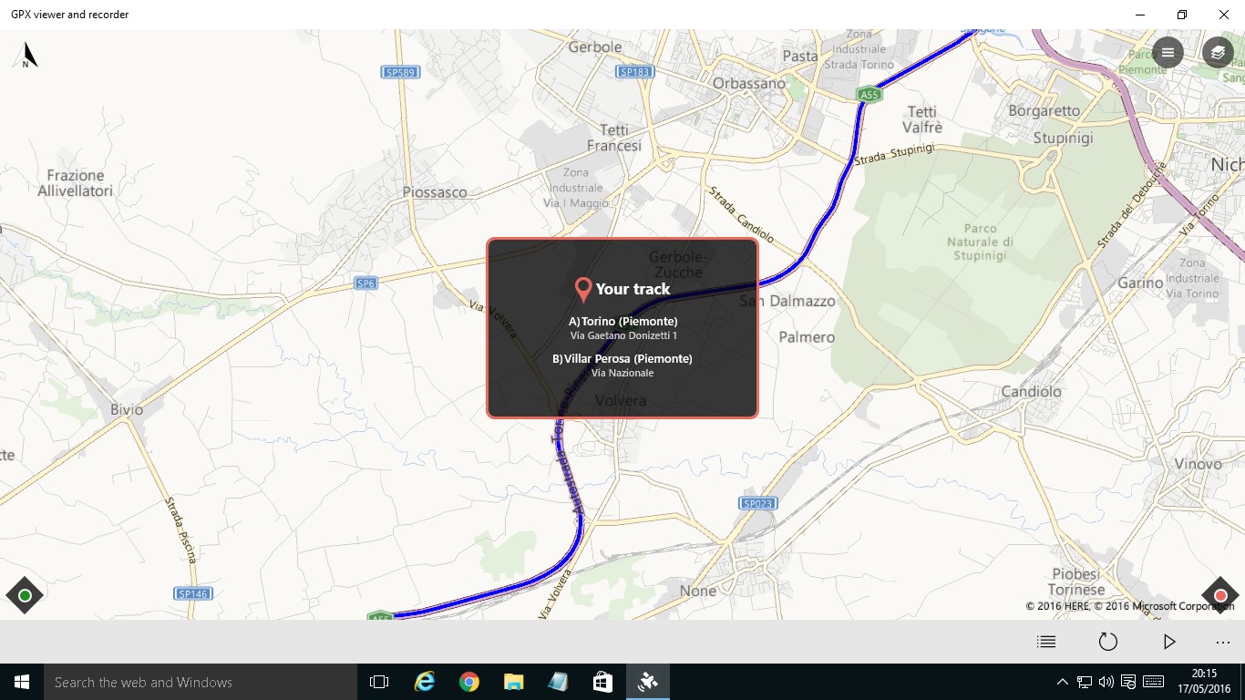
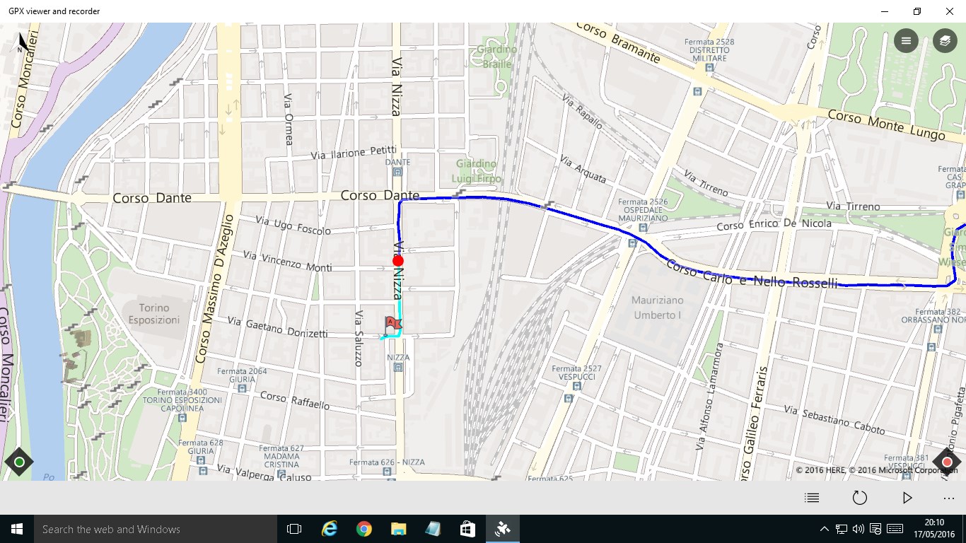
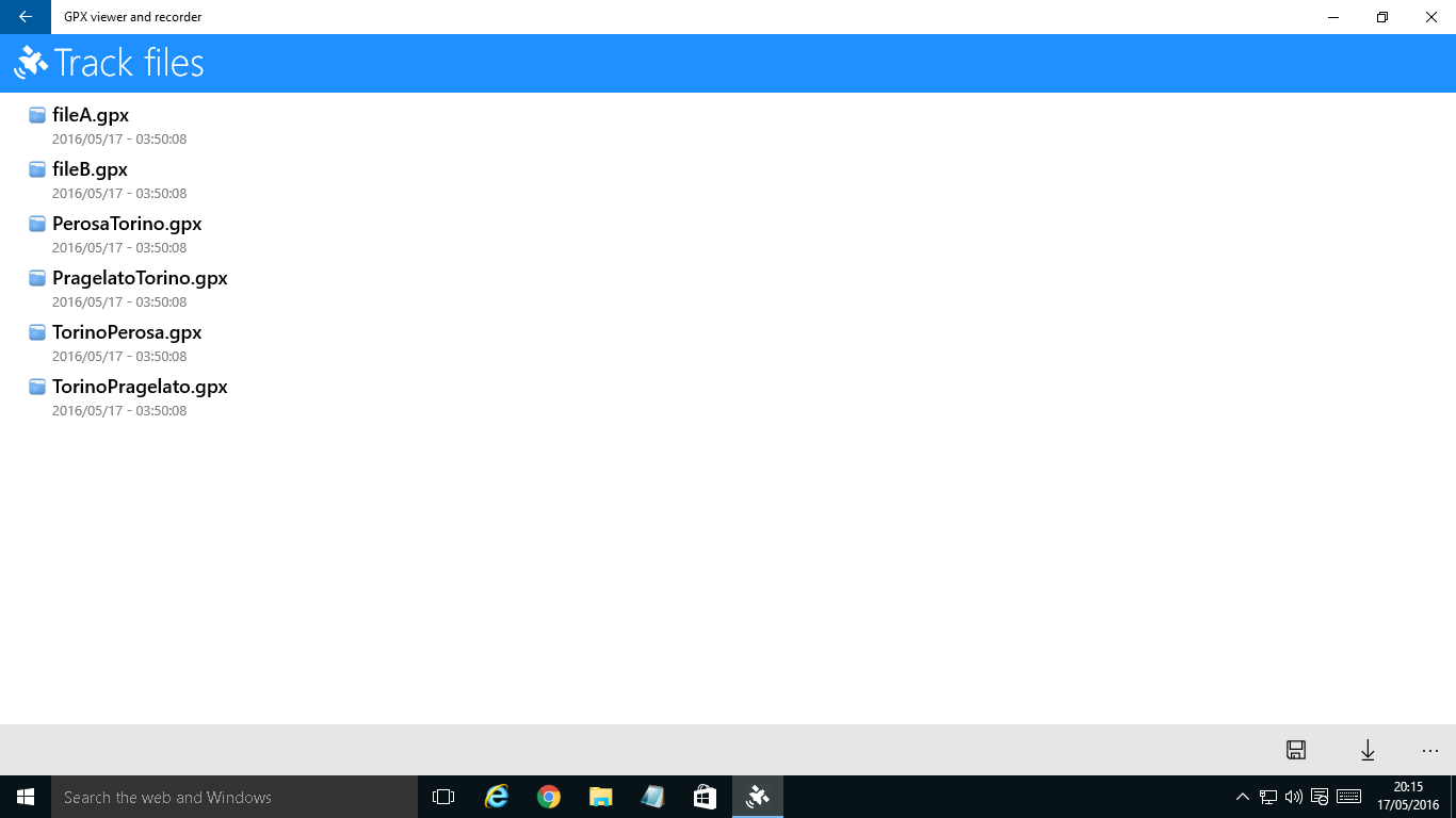
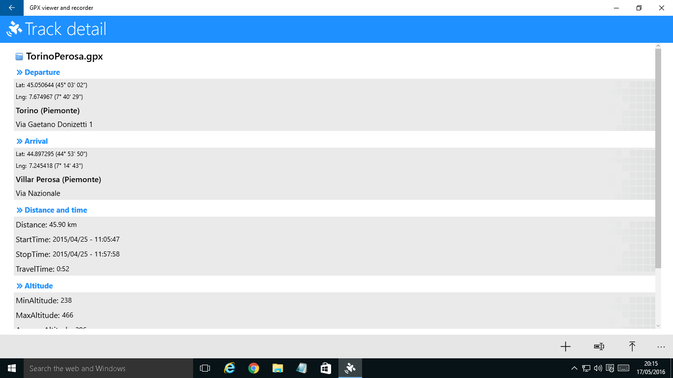
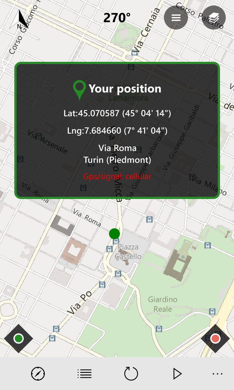
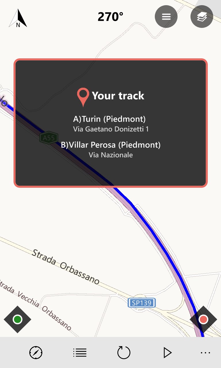
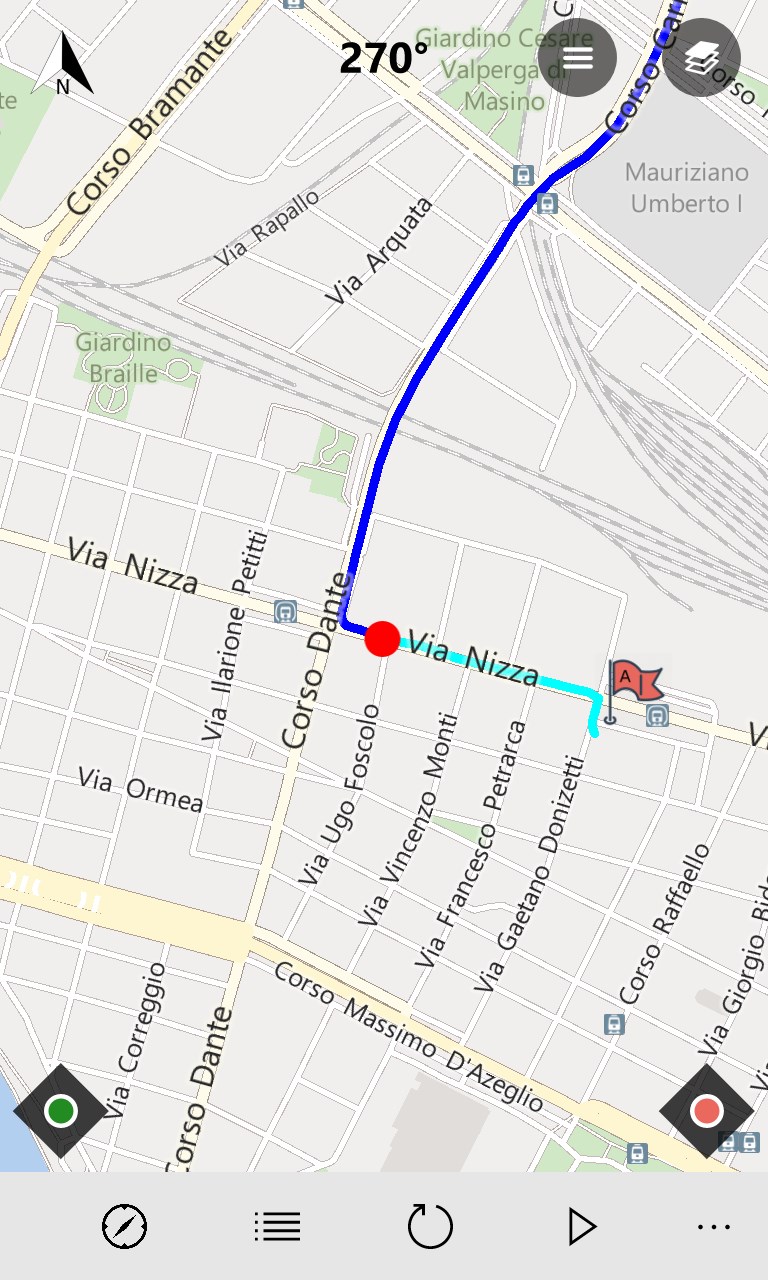
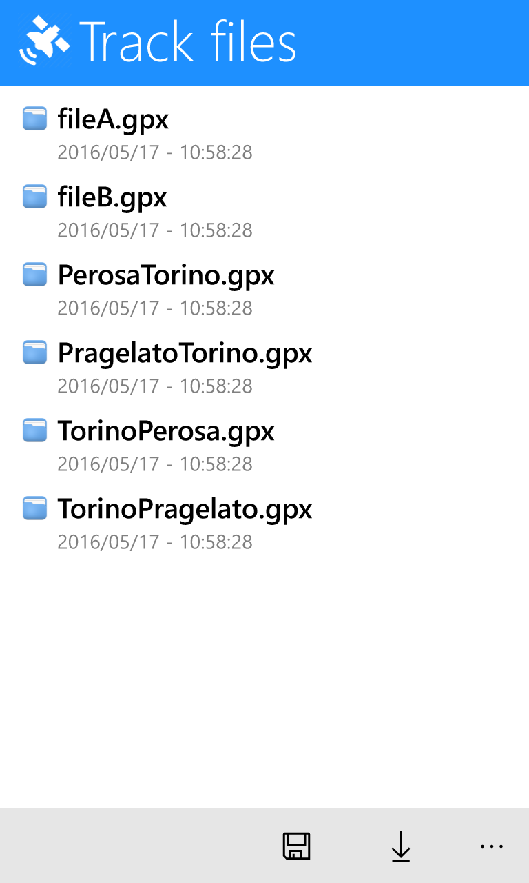
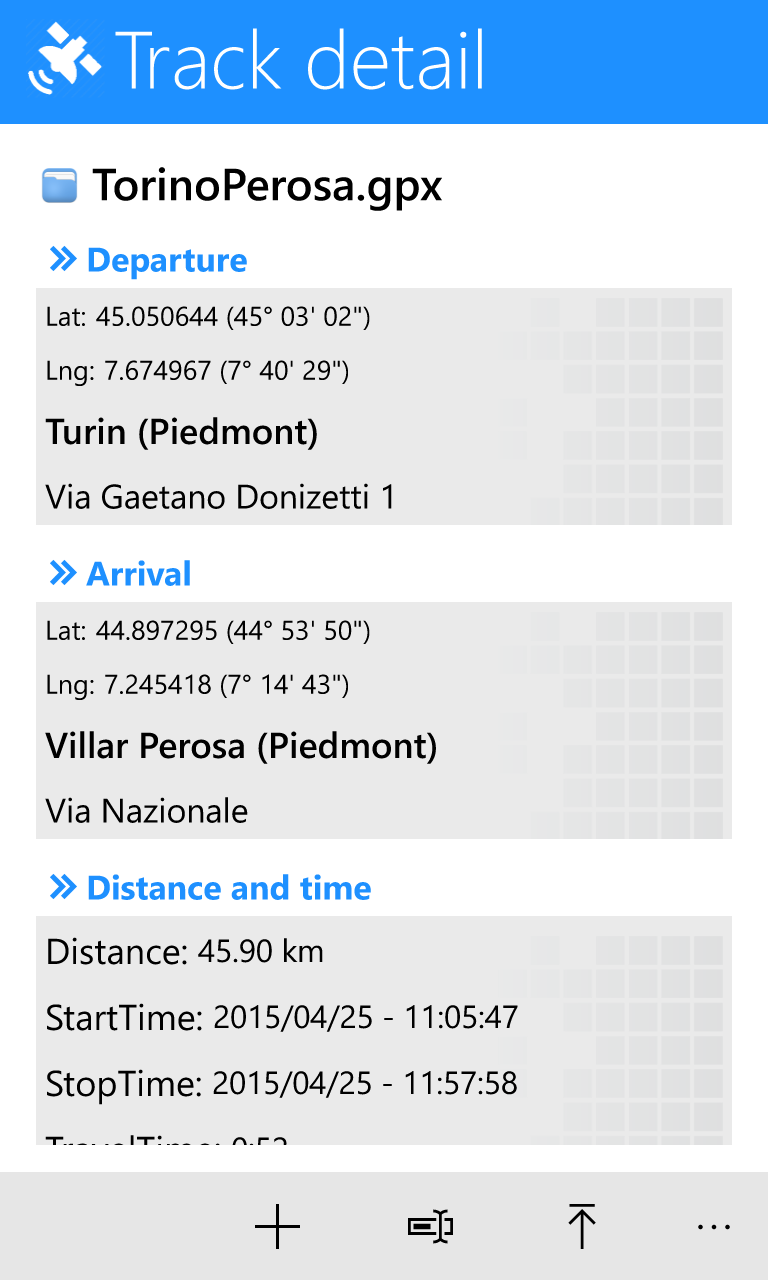
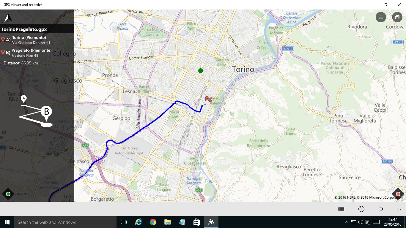
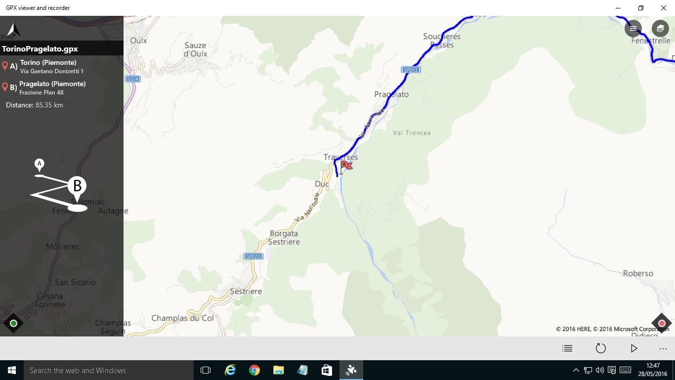
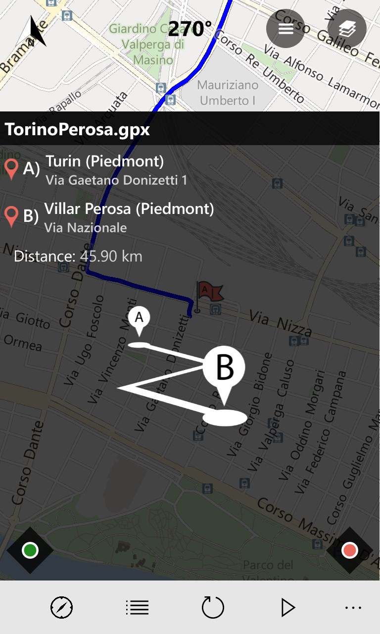
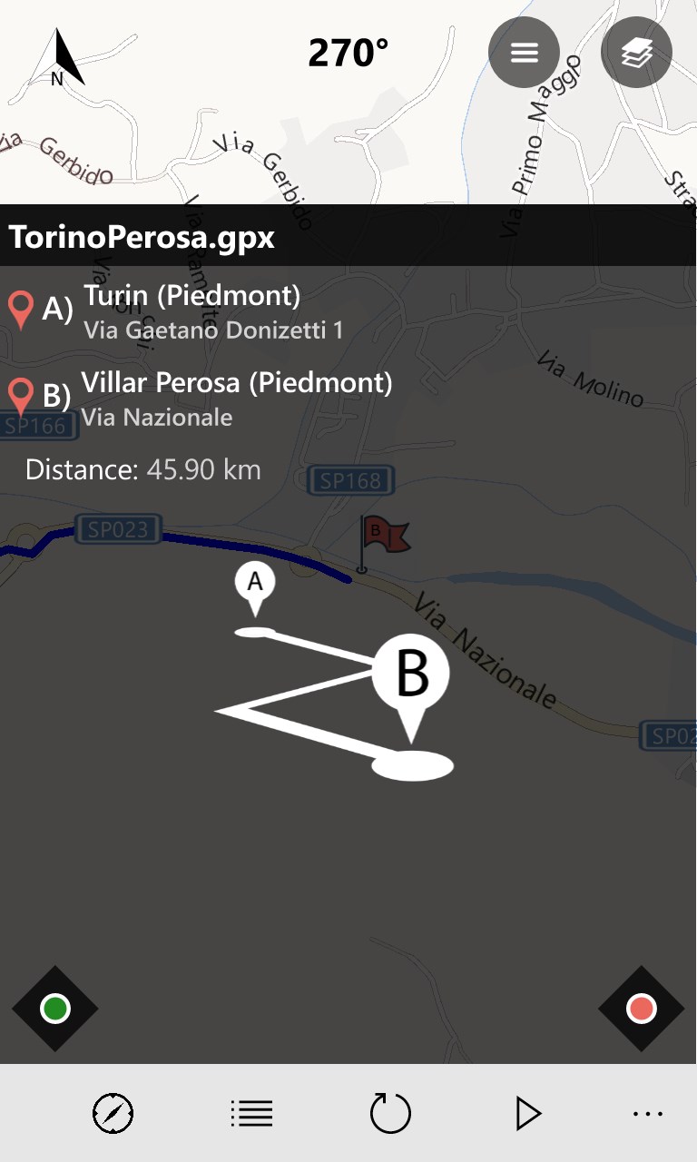
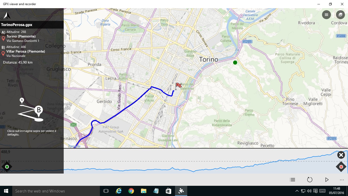
  • View GPX file (tracks, routes, points of interest) of our excursions
  • Also the maps: OpenStreetMap, OpenCycleMap, Hike Bike. Useful to follow mountain trails
  • Record your route / path of your trips (cycling, snowshoeing, hiking)

Comments View all

254 comment


avatar

13 July 2017

Allows me to plan my hikes.


avatar

10 July 2017

Just getting started, but seems accurate and easy to use.


avatar

10 July 2017

I like how straightforward it is to use this app. I wish there was a way to display all GPX files at once however


avatar

8 July 2017

Does not open any of my .gpx files. Attempts to open any of them result in a never-ending time-out in my File Explorer window. I tried the uninstall & reinstall with no success. I'm going back to Garmin .gdb files. And why does the app need to know my home location when I plan routes to start/finish at locations other than my home?


avatar

8 July 2017

This app is easy to use. There are many options to use your data with. The maps are great.


avatar

7 July 2017

Still testing


avatar

7 July 2017

App was very well designed. Just tried it on mobile and installing on PC now. THANK YOU for making it cross-platform


avatar

7 July 2017

super


avatar

6 July 2017

Perfect for my off road adventures


avatar

6 July 2017

easy to use

Load more